Category Archives: Uncategorized

A second adventure in Australia

14th February Hong Kong Airport

Well here we are then, just leaving Hong Kong. The final stage of our second journey to Australia and time to do the IPad equivalent of sharpening my pencils, tidying my desk and drawing my margins…….. basically remembering how this blogging business works. 

Travel feels different this time. I have retired. Really, really. The training and reference books have gone to the charity shop, the testing materials have been shredded, my notes have gone on the fire. It is finished. The next phase begins and I feel unbelievably liberated. Why I do not know. I have been doing very little over the last few years, so why should this be different? Perhaps it is because my last role was not very satisfying for me. Perhaps it is just that it is the right time. In any event – thank you CTN. I am not sure I proved very effective for you – but you have funded this trip and allowed me to draw a close on my HR career with no regrets.   

Time to move on and look forward with excitement to our second Australian adventure. We will visit new places, spend time with much loved friends, remember shared experiences, ruminate over news and views and no doubt share the odd sherbet. Whatever the next couple of months brings, I am confident that it will be fun, memorable and life changing. Travel always is in my experience……..
So, after the shortest Valentines Day I am ever likely to experience, let’s go…….
15th February 

We arrived in Sydney at circa 9.30.am.   It was a beautiful day. The temperature has dropped from the giddy heights of the recent past, but it was still 25 degrees. After a rather chaotic exit through passport control and customs, we met up with the girls – including Helen who had flown in from Alice on the 14th. It was great to see them all.  

Within no time we were in the car and heading off to Newcastle, to meet up with another chum, Peter who has moved from his goat ranch where we had visited him on our last visit. We drove from the airport over the famous Sydney harbour bridge, which seemed to formally acknowledge our return to the antipodes.  

Our drive north passed through suburban towns which seemed to be almost continuous for the couple of hours drive north. Just after midday we stopped to eat at a great little cafe at a place called Toronto where we ate a really scrumptious lunch on the side of Lake Macquerie, the largest permanent coastal saltwater lake in Australia. The sun shone and it was great to see the women in colourful summer attire (like butterflies or vibrant moths dazzling us after the greyness of the UK winter we had left behind).  

It was only a few minutes from there that we arrived at Peter’s house – how good it was to see him. It was almost emotional when he said to Keith – ‘like MacArthur, you said you would come back –  and you have!’ Great stuff and it felt like we spent time with him at his goat ranch only yesterday. What a difference 18 months can make. We looked around his new single story home, built to limit the impact of the sun and furnished quite minimally  but with the constant backdrop of the murmuring of three great fans constantly swishing the air to keep the main room cool. Already we were feeling that this was sanctuary from the glaring heat outside. At the back of the house there was a stand of huge eucalyptus trees, providing a constant theatre backdrop of bird life to keep Peter entertained and keep him on touch with the wild life that he loves. 

We spent a very happy first evening over an excellent meal remembering past shared time and travel and walking experiences that have taken place since our previous sighting of each other. It was great. Having met while travelling, it continues to be the common denominator that binds us. The conversation hopped from Patagonia to South Africa, from Spain to Croatia and beyond.  

We were amongst friends. 


16th February Newcastle

We woke to the sound of the kookaburras ‘laughing'(!?!) outside the window around 5.00 am. Not so much a laugh as a shreak and we were not invited to share the joke.

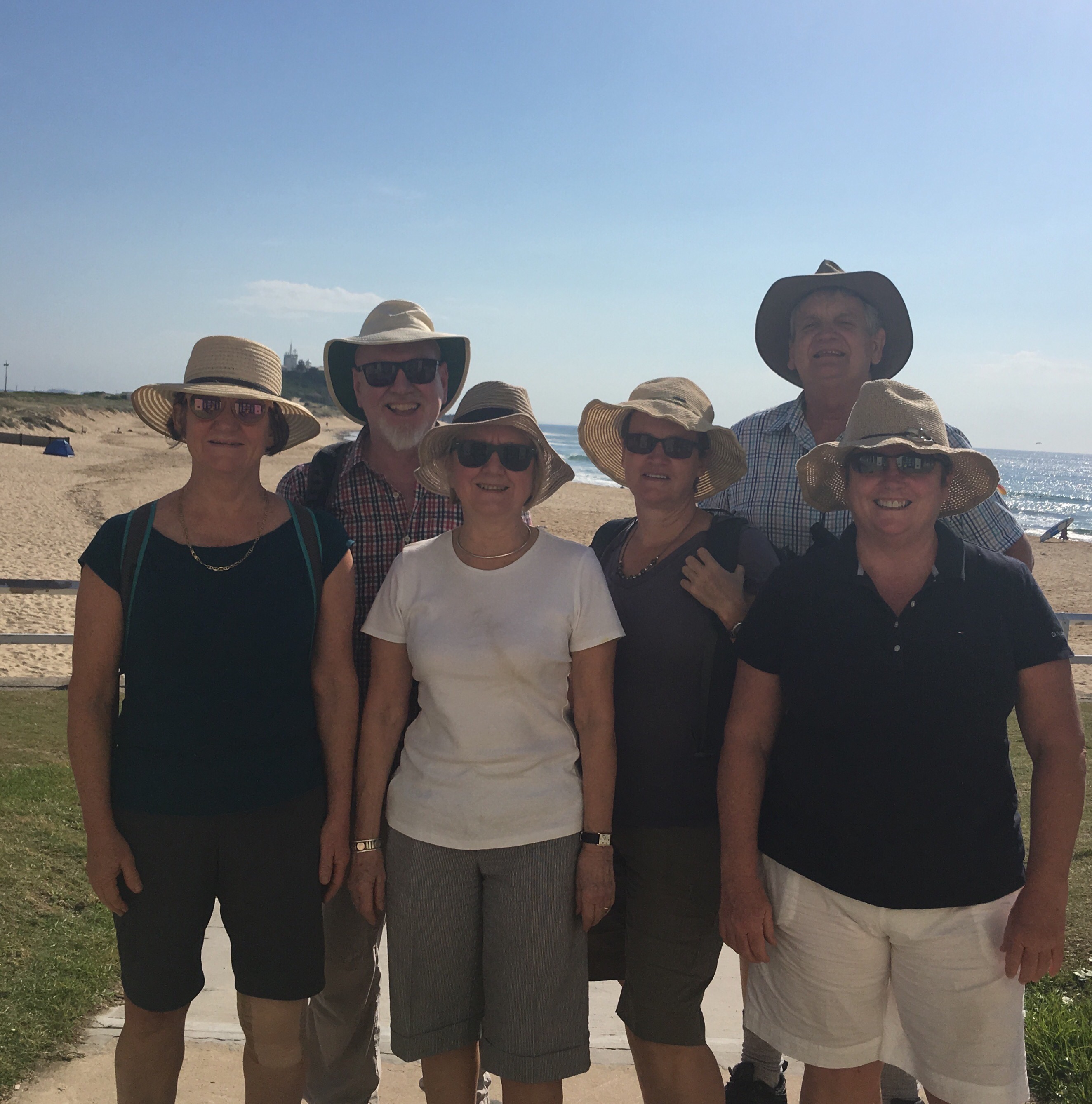
We were up early to get out before the heat of the day. Wendy and Sarah arrived from where they were staying with family locally (we were staying with Peter) and we set off to the sea. 


Newcastle was founded on coal. The story goes that a chap was sent up the coast from Sydney in the 1800’s to find some escaped convicts. The convicts were never found but a seam of coal was sighted and Newcastle was born. Initially the coal was shipped to Sydney. Now it is despatched world wide with much (as in all things Australian) heading to China. Looking out to the misty horizon of the sea, huge tankers could be seen in the shipping roads leading into the port waiting to be filled with coal or grain. 

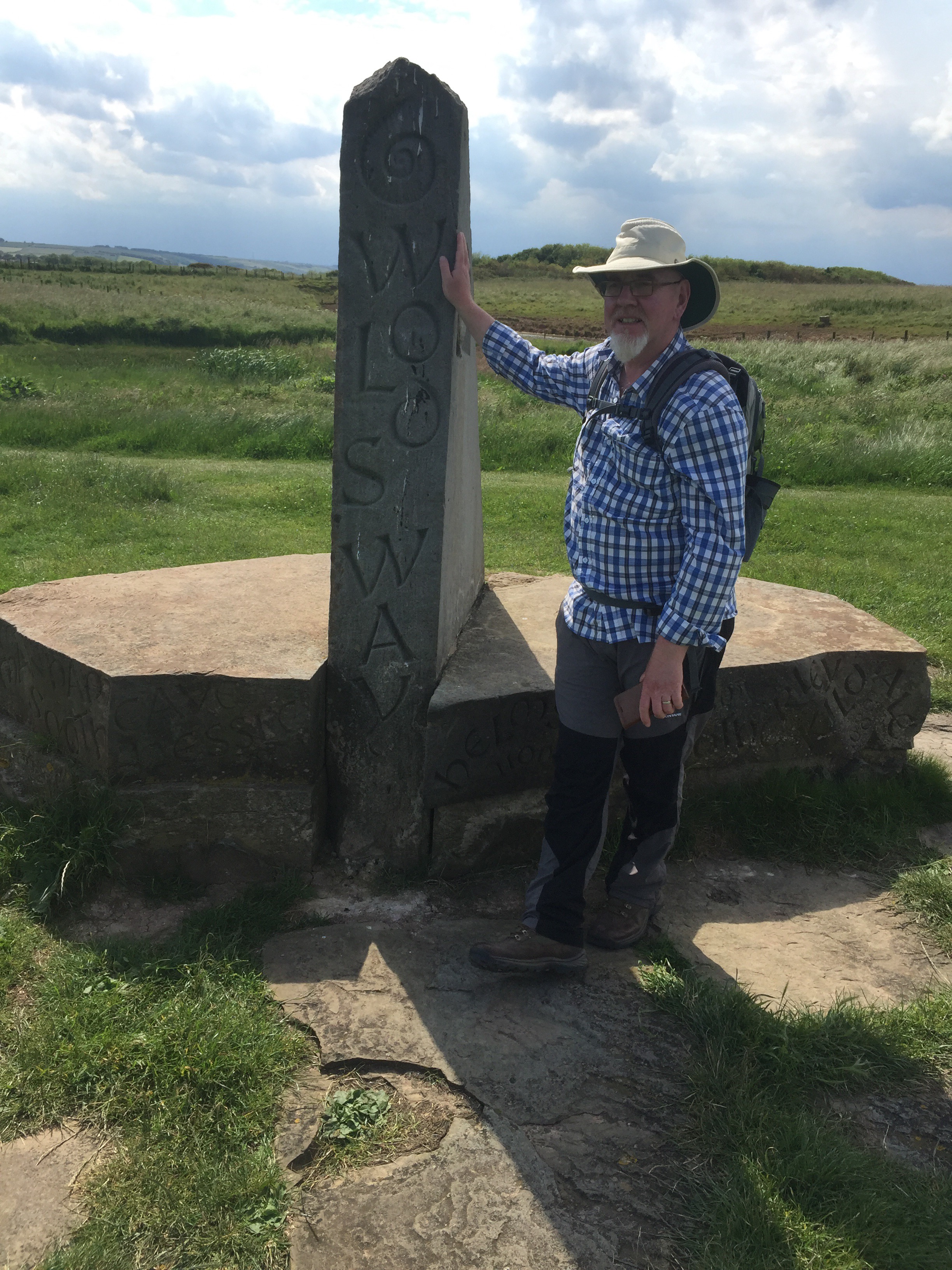
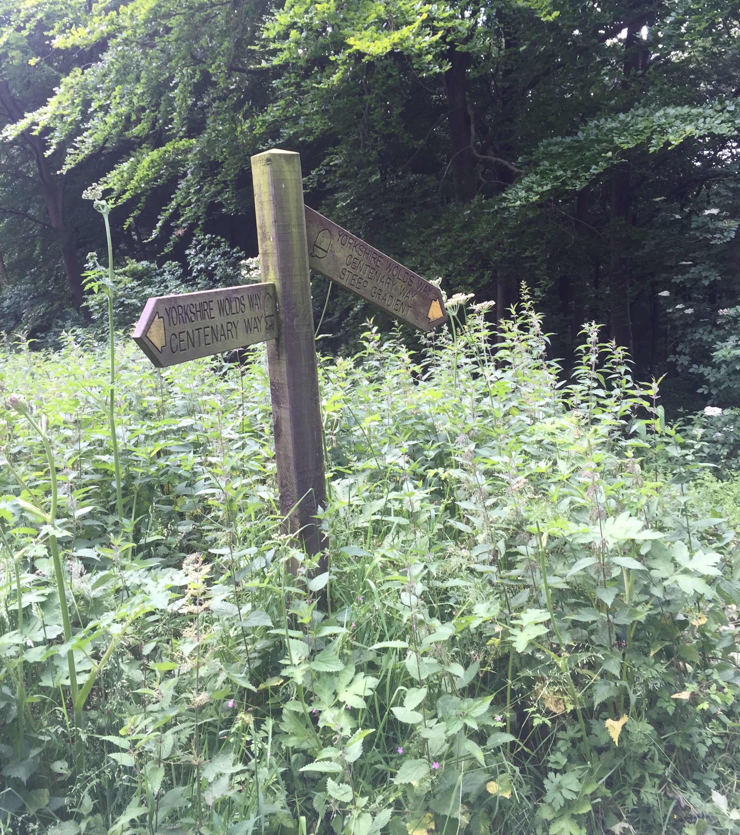
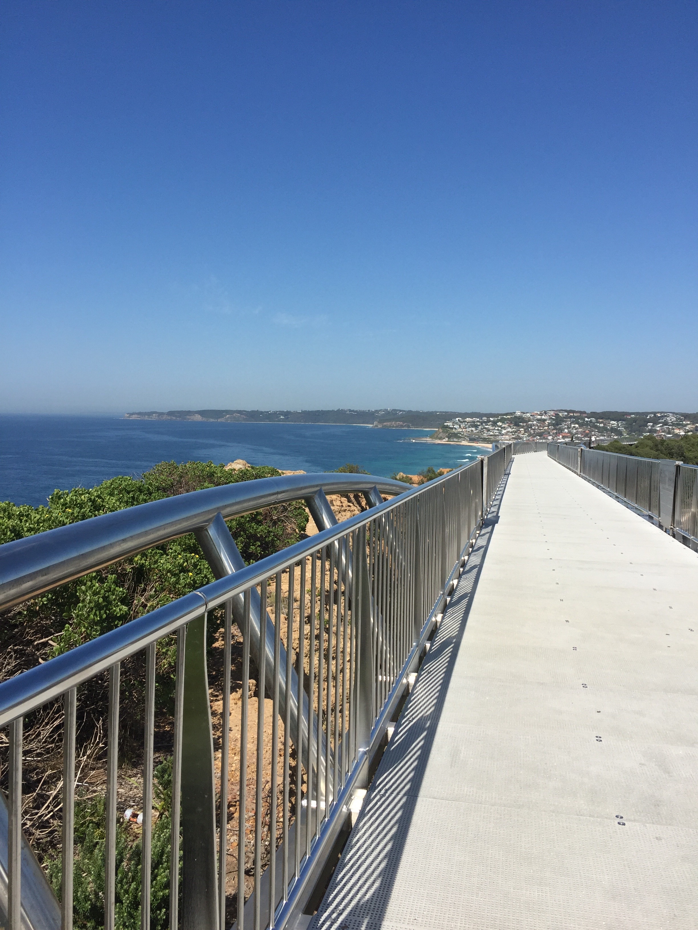
The town was a real mix of industry and leisure. From the coastal path where we walked we could look inland to the docks edged with cranes and vast hoppers, busy with tugs and pilot helicopters criss crossing the harbour and outlet of the Hunter River – actively involved in getting the tankers into place through the harbour entrance.  

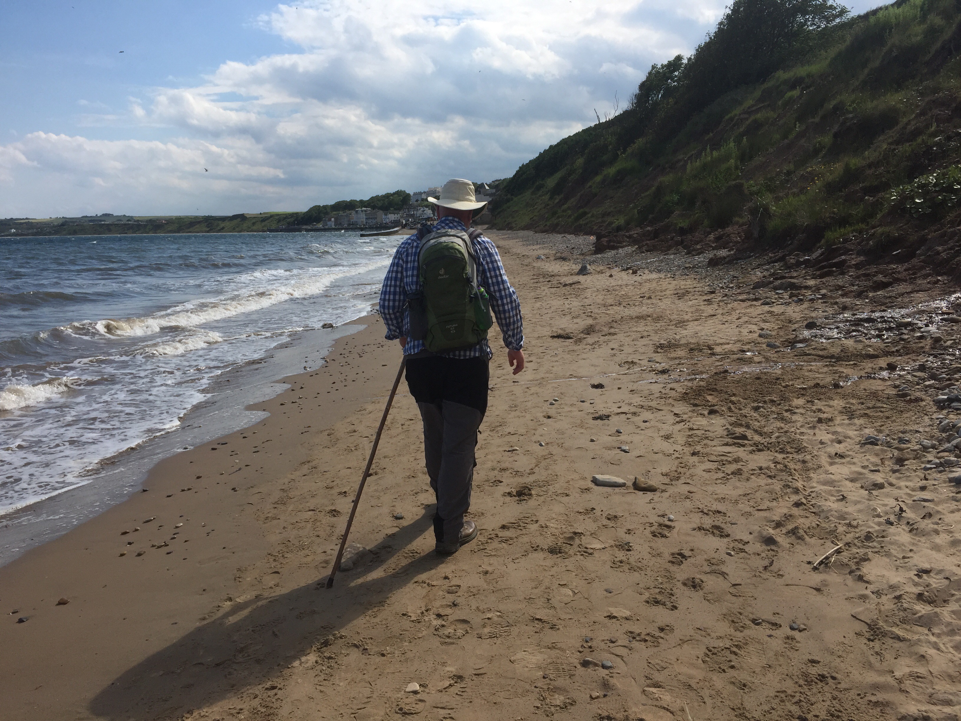
When we looked to the seaward side, we looked immediately down on the clear waters of the rocky coastline or along to golden sandy beaches dotted with scantily clad sunbathers and the bustling activity of surfing life. In addition to the helicopters taking pilots to the ships, there were others checking the water for sharks. Along the coast path the debris of old forts and sea defences stood stark memorials to past times. Large cement structures reared up from the turfed cliff top with mangled rusting metal prey to the elements and erosion. At other points designer houses skirted the coast road and dripping surfers hopped along the hot pavement with their boards under their arms as they returned to their vehicles.  Cafes spilled their coffee drinkers on. To the sidewalk.  The epitome of Australian life. 

Our route continued along the Anzac Memorial walkway which sported the rusting sculptured silhouettes of the men and women of NSW who had volunteered to go to the aid of Britain in the First World War. 


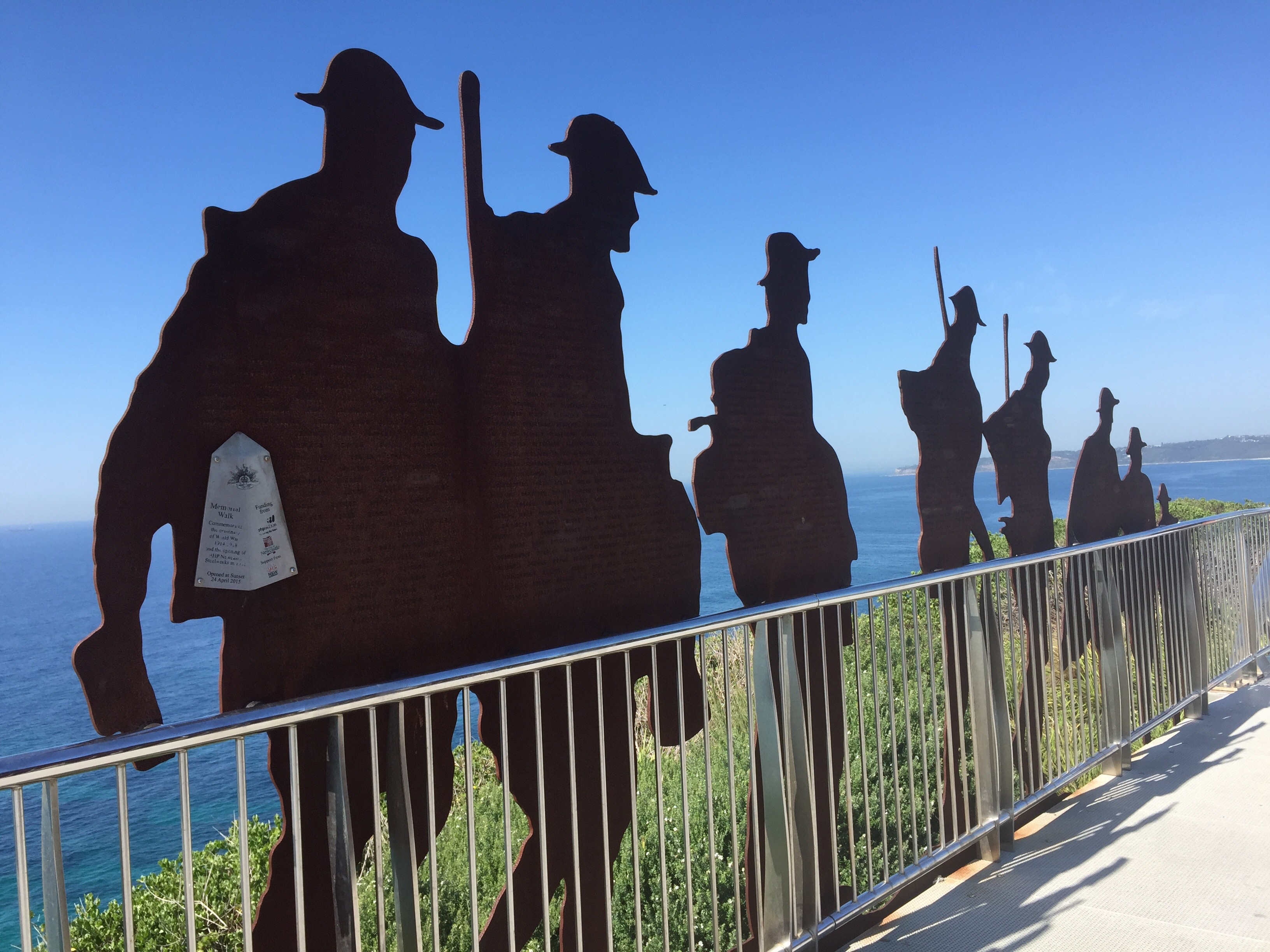
 On one poignant plaque the names of all the local people who had died were faithfully recorded. A somber note in the seaside scene in front of us.


 Below a school of dolphins broke the surface of the water. Overhead the sky was cloudless and the sun beat down on swimmers, sunbathers, those who walked the coastal path and the monument to the young dead whose lives ended so far from home.  

We continued to walk along to the end of the bay where we found a very welcome hostelry where cold beer was very well received.  At this point we parted company with Wendy and Sarah and took off to the harbour edge to have lunch.  

It was then home for us for a siesta and early evening drinks in the garden watching the antics of the rosellas and other birds in Peter’s tree theatre…….

A good day!

17th February  – out and about around Lake Macquarie 

Following the now familiar kookaburra alarm it was another early start to make the most of the day before the greatest heat descended (the temperature was to rise to 38 degrees by the end of the morning).   This time we headed to Lake Macquarie, starting at Wangi Wangi point – a conservation area jutting out into the lake.  

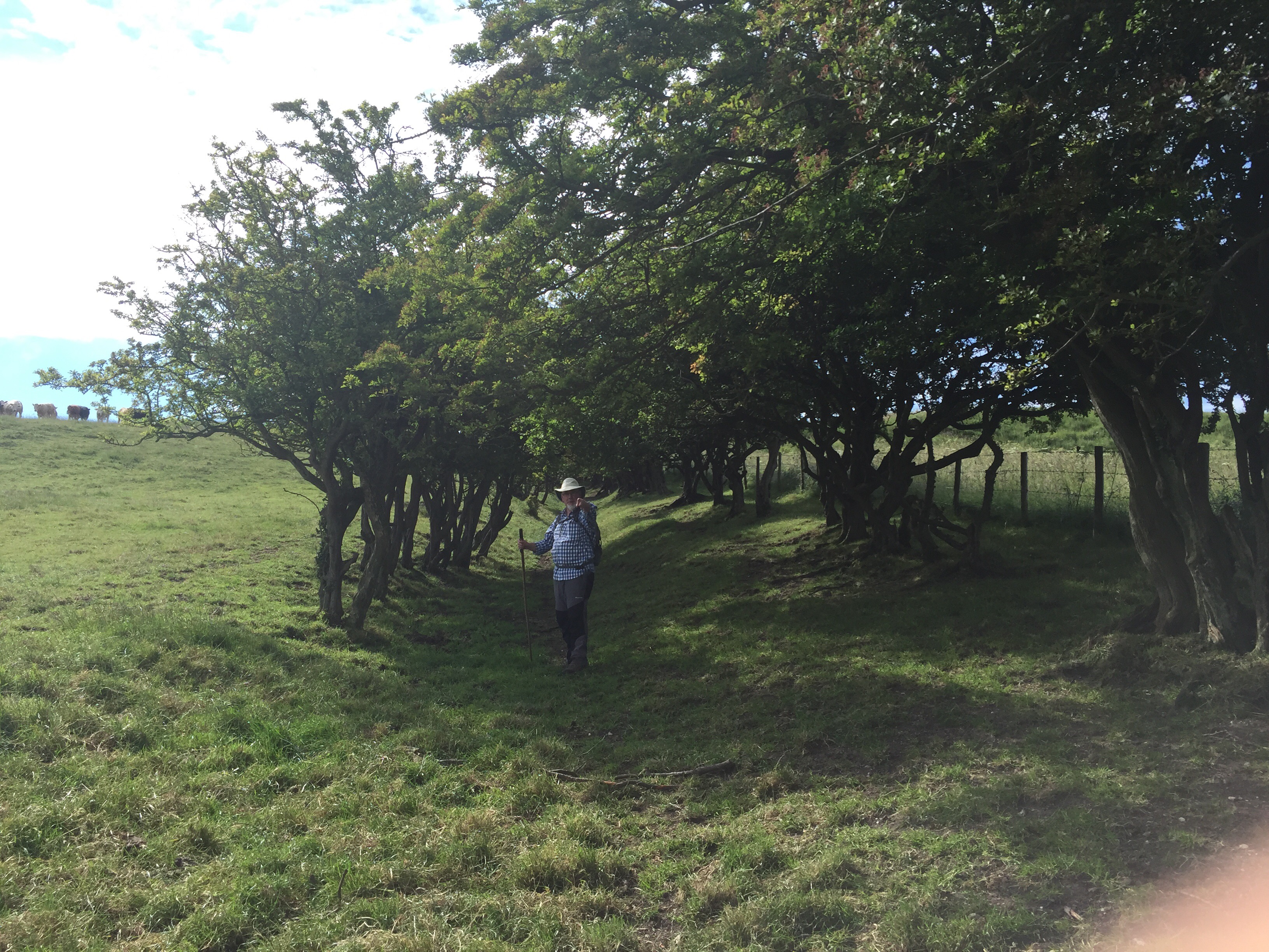
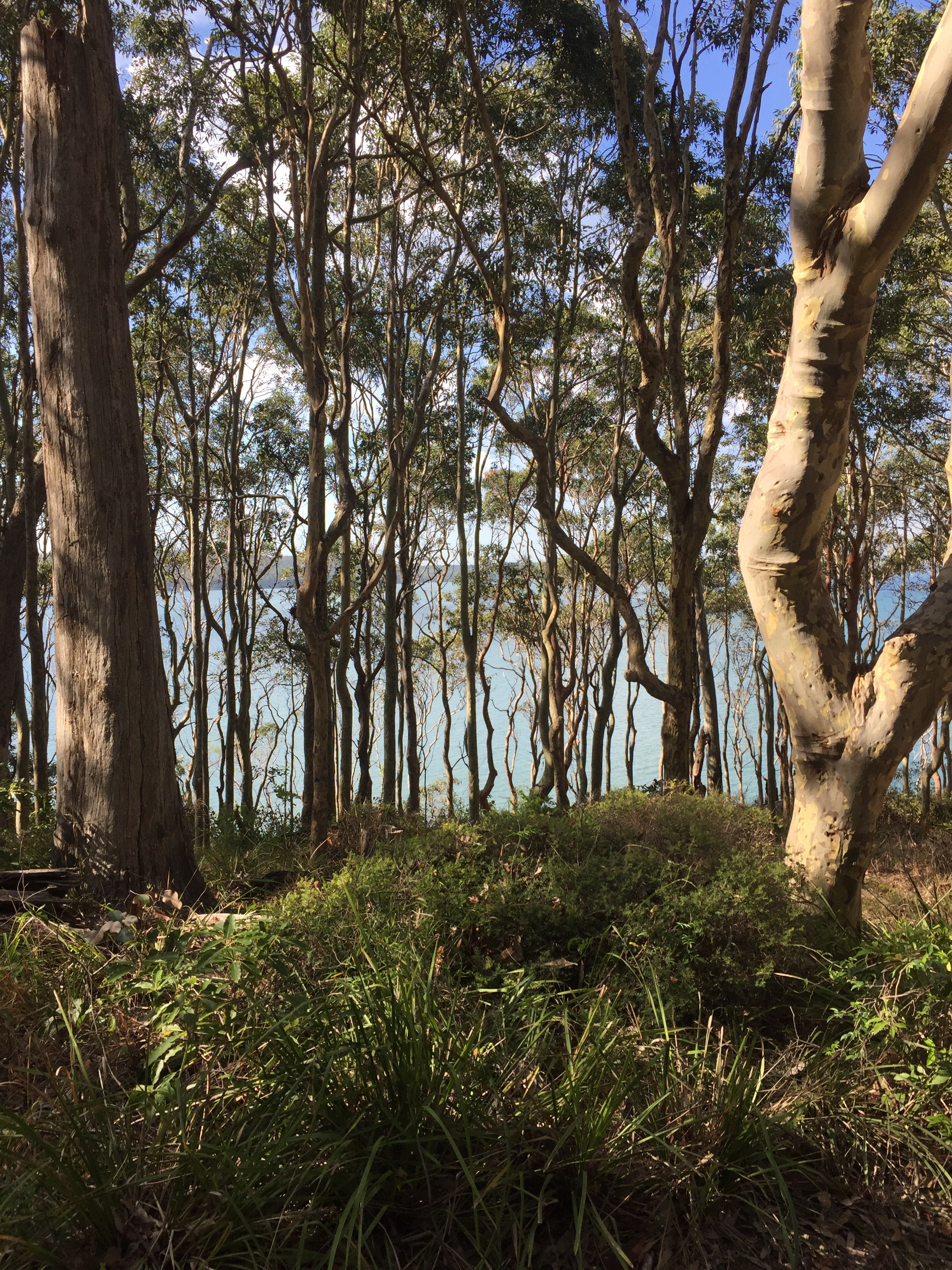
We wandered through the trees to the water’s edge.  As always there was evidence of many of the trees having survived burning.  We saw iron bark trees with their tough surface built to survive the ravages of fire and paper bark and stringy bark trees that the aborigines use to make rope. 
We wandered along the waters edge.  The water gently lapped along the shore line.  The sun sparkled on the water.  


Eventually we turned in land again and eventually returned to the car.  As the sky was looking overcast it was decided to take a coffee break until what turned out to be a storm had passed.  We had just settled down to our drinks when the heavens opened……. perfect timing!!

The rain soon stopped and we were on to our next port of call.  This was a place called Green Point Nature Reseve. where we set out from somewhere called Dilkera Avenue to walk to Black Jack Point.  I just love the names here – they are just the business.  We seem to either have the names of all the prominent British towns and cities or they are completely piratical or unpronounceable!  Great stuff!

This walk went deep into a rain forest area.  It was very steamy and very hot.  It was a lovely walk though.  Once again we followed the Lake side.  Along the way we passed a white faced heron. 

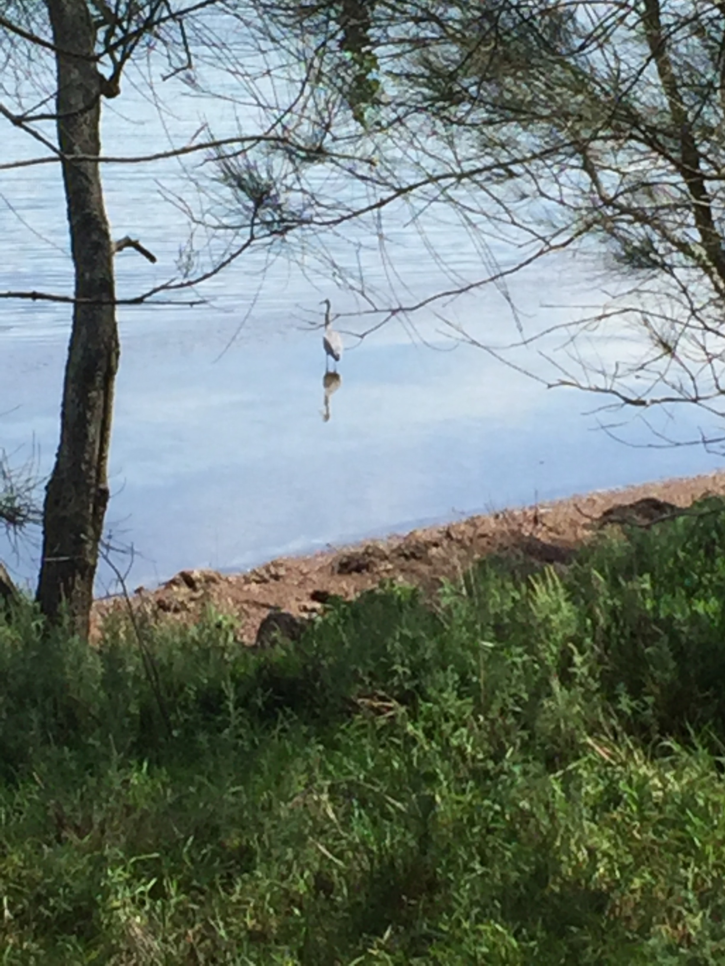
Emerging at Black Jack Point and it was time for lunch and home for another siesta…….

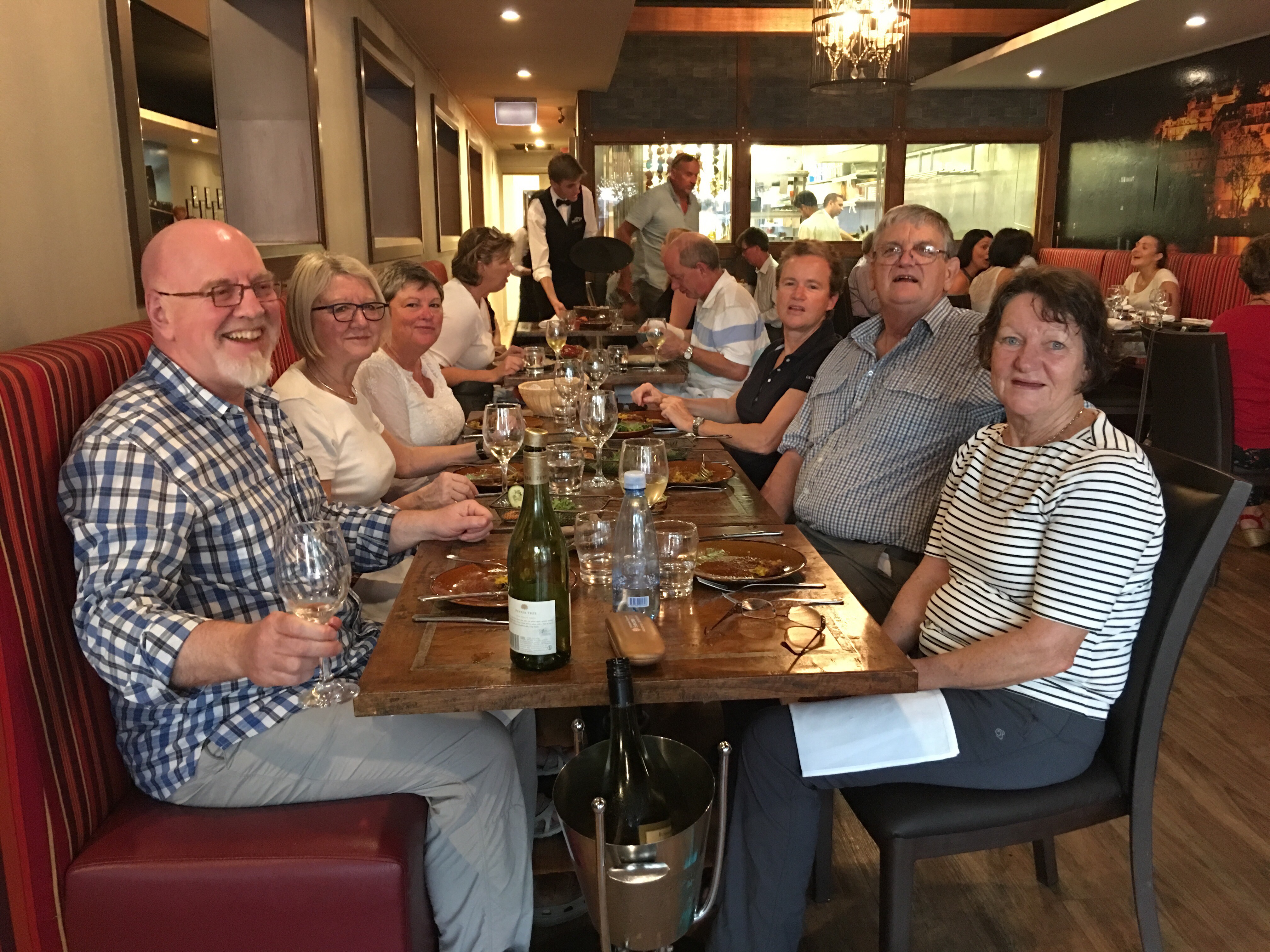
We spent our last evening in Toronto (!?!) with Wendy and Sarah’s family, eating Thai food against the backdrop of lorikeets cheeping in the trees just beyond the balcony tables. The noise reached fever pitch around  9.00 pm and then the sound dropped and we were left to enjoy the scenery of the lake.  We drank champagne and excellent Thai food.  A great evening.  

And so to bed……..

Ganton to Filey Brigg

Our cab arrived at 9.00 to take us back to Ganton to start our last days walking.  The day has started out to be overcast, but by the time we started walking up the street f whitewashed houses in Ganton, the sun was out and the day was already warming up.  

We turned off the Main Street and over the stream that runs down the side of the road.  After walking alongside a hedge with the spire of the 14th century Ganton church behind us, we turned up hill along a path that was quite hard work and set the tone for the day really.  


The ground was uneven and covered with grass, with thistles, burdock and nettles waist high on both sides.  We ploughed up the hill and then turned up past a row of gnarled old trees.  As we moved up the avenue a line of cows appeared on the hill top behind it. 


We turned left, right and then left again to reach a road. At each field edge we battled with the undergrowth, trying to find our footing along the path.  We were pleased to cross the road and follow a farm track for just over a mile.  We passed the farm and could hear the grunt of pigs as we passed.  At the end of the road we turned a sharp right passing an RAF station on our left.  The track continued along the perimeter fence with its dire warnings to anyone entering uninvited and RAF Staxton Wold mast.  It all looked very mysterious……

After passing a second pig farm the path deteriorated into a sunken path.  Just as it began to level out we took a left turn up a very steep hill.  It was really steep and slow progress as our feet slipped on the gravelly chalk.  We reached the top and after passing through two kissing gates and came out onto a wide landscape described as ‘wonderful but demanding’ section of the trail.  We ascended and descended the rolling hillsides And then climbed a steep field edge to meet another Tarmac road.  As we walked along I got my first glimpse of Flamborough Head to the left.  To the right was the rolling landscape we had just left behind. 

When we turned off the road about 350 yards further on we began the most difficult part of the whole walk.  The path had not been cleared so we struggled with the terrain, but after a big deep down slope and rise we then started on a big dog leg around the top of a hill with the slope of the hill constantly with one foot hitting the ground lower than the other.  It was very uncomfortable. Then to add to our discomfort a way sign appeared telling us we still had seven miles to go when we reckoned we had already done 7 and probably had just five miles outstanding. It was pretty discouraging. 


However, we kept going. Our route took us around the other side of the hill and we descended into trees.  We then walked along the valley under trees.  Eventually we came out onto the road.  It was such a relief but we went ahead on a field edge and more poppies!

Lovely!


At last we reached Muston and a sign that said 2.5 miles to Filey.  This did not tally with the previous signpost but seemed much more in keeping with our own measurement of time and distance.   We were both very thirsty and Muston was said to have a pub.  Alas for the second time the promised drink was to elude us – the pub did not open on Mondays!  We both felt pretty depleted.  

We took a a left turn just short of the end of the village and then set off over a couple of fields and eventually came out by the playing fields of one of the Filey schools. We were nearly there!  Emerging on to the road we got caught up with the young people coming out of school (at 2.30?!).  It was as though we had been caught in a movement of a pack of wildebeasts! There were large packs of long legged young men and women travelling at their own pace and occasionally crashing together in a flurry and nudging of school bags (what happened to the satchel?), shoulders and legs……. We felt very old and out of step!

We crossed the road as soon as possible and, having crossed the railway line, headed to the micro brewery we knew was on one of the main streets to the seafront. Closed on Mondays.  The despondency was increasing!  Having made do with liquid intake at the rather lacklustre Star we moved down towards the seafront and luckily found the steps that led up to the cliff top and our final objective – Filey Brigg.  After several flights of concrete steps up through the trees we came out onto the grassy headland.  The sun shone, dogs careered around and mobile homes were lined up to take the bracing air and make the most of the weather.  


We arrived at the marker that denotes the end of the Cleveland Way completed at this point only a few weeks ago and the Yorkshire Wolds Way.  Photographs were taken to mark the completion of another long walk and we adjourned to the seafront to celebrate.  


Keith with a pot of cockles and me with a caramel fudge ice cream. Perfect!

Winteringham to Ganton

We left the Cross Keys and Thixendale, a really lovely village community, behind us and were taken back to Winteringham to start the day where we left off.  We said goodbye to Mary and thanked her for her many kindnesses and set off by the church.  Initially we took the field edge and then entered a wood and were confronted,  after a sharp right turn, with an extremely steep hill. The guidebook described it as ‘thankfully short’ but this was no real comfort as I slowly moved up the slope.  I think nothing described it better than the Wolds Way sign when I (eventually!) reached the top!


Having reached the top and entering a field through a red gate, we were at a spot I have visited previously.  It is another of the art installation of the ‘Wander – Art on the Wolds Way’.  It is called Enclosure Rites and it was a  lovely day on which to see it. The sun was out.  The Vale of Pickering stretched out in the distance………


I particularly love the gathering of people – pilgrims?


Turning back along the trail we were heading east – we have turned towards the sea having headed north more or less since we left the Humber Bridge.  I heard my first seagulls! Once again it was an ancient path lined with a gnarled old hawthorn hedge initially.  We then entered woods and walked amongst the trees for some time.  Emerging from the trees we contained on the same tack, turning up the field to pass around another wooded plantation.  Looking down from our ridge we could see East Hetherington village and the main road that was running parallel to us below.  


After passing  Manor Wold Farm and the road that was just beyond it, we continued along the path, often pushing our way through grass and nettles waist high.  It was quite hard going!  Keith had set his heart on a roast lunch at the Greyhound pub in Ganton where we were heading, so we were maintaining quite a pace. After several more ups and downs we came to a Tarmac road which we took for about a mile and a half before taking a left turn just north of the village of Sherborne.  At the end of this path we turned right on another quite busy road before turning off this at a left fork.  Another very steep hill but quite short lived before we turned off along a field edge and then entered a small wood.  Emerging from this we followed another field edge and eventually emerged on to a sandy lane on the edge of Ganton Golf Course, which amazingly has world class status!  Championship golf is played here and apparently a number of the top professional golfers practice on the course. Not many people know this!!  I have to say it looked slightly odd as there seem to be a pea field in the middle of it!  

Skirting the golf course we turned left again.  Ganton could now be seen ahead.  Keith’s roast beef was about a mile away!

We passed another farm and then reached a road to turn down into Ganton, just glimpsing Ganton Hall through the trees to our left. 

Ganton Hall is a large 19th century mansion and the seat of the Legard baronetcy, which dates back to 1660. 
Reaching the main road we found the Greyhound Inn with a table for two hungry walkers. Great! 

Last day tomorrow. 

Thixendale to Wintringham

Following a good breakfast at the Cross Keys and after dropping into the village shop for an interesting chat with the smartly bewigged lady behind the counter, we set off up the hill out of the village. 


Thixendale

Two young women came up behind us and moved on ahead. It was dull and breezy as we turned our back on Thixendale and moved on over the hill. We were surprised at this point To come across some highland cattle.  Busy taking a photograph of mother and son, I was somewhat surprised to see the head of an enormous bull, complete with large nose ring, appear over the bank……. I decided at this stage that a family shot was sufficient!


Mother and son……


First horns appear…….


……. And then Dad arrives!

We had not gone far when we came to a place where the path crossed to the other side of the hedge.   The girls had continued, chatting, along the hedge line. We shouted but our calls were lost on the wind.  We eventually emerged on the road and about 100 yards along behind us our lady friends had emerged heading in the wrong direction!  After fierce gesticulations on our part they got the message and headed down the road.  They were back on track. 

We moved from deep valleys to open fields.  After some ups and downs we found ourselves on a long stretch of green lane going straight ahead for over a mile. There were wonderful views to  the north. The weather was fickle – one moment rain and the next sun emerging from behind the cloud. 

Passing through a field gate we started to descend into the deserted medieval settlement of Wharram Percy.  There is evidence of at least one Iron Age house here in addition to a Roman Villa. The village grew under Anglo Saxon settlers and for three centuries it had a population of circa 150. Unfortunately the Black Death and a change in farming methods led to the village being deserted and it is thought that the last house was abandoned in 1500. The first thing to be seen was the skeleton of the church appearing over the slope of the hill.  We then descended to the fish pond, beautiful in the sunlight and then the grassed over foundations of ancient peasant houses.  A lovely spot. 


We then moved on, taking the route up through the tall grasses beside the path up to the car park for Wharram Percy and out onto the road.  The sun which had come out for the medieval village fast disappeared and it started to rain. After a fair bit of road walking we turned down into the small village of Wharram Le Street.  We then struck out to the right of the road that made up the village on the bridle way that wended its way up the hillside away from the road.  At this point the two young women and two elderly gentlemen ( who put their umbrellas up against the rain where upon the said umbrellas more or less immediately blew inside out – I wonder if they have tried anoraks with a hood?!) who we had also seen along the path were ahead of us.  

Not long after this, the girls had missed another turn off and we had brought them back on track and the elderly gentlemen were disappearing up the path on the wrong side of the hedge!  We all shouted to gain their attention and were then concerned to find them trying to climb the fence.  They were eventually persuaded to walk back the 100 yards to the turn to get it right. What extraordinary behaviour!  Dear me!  They were all hopeless!  The route is very clearly marked.   It felt a bit like the hare and the tortoise! 

After crossing a road we were moving upwards and after a turn down to cross a small beck we were heading upward again. We were travelling over farmland and eventually came up to farm buildings where I was amused to see a kayak parked.  Flooding up here seems a little unlikely!  

The views were broadening out …….

In the distance, beyond the vale of Pickering, the North Yorkshire moors could be seen on the horizon. 
Our route then took us along the edge of woodland and eventually down a long field edge.  Winteringham, our objective for the day, could be seen ahead.  A turn to the right at a reservoir and we entered the village. 

We headed up the road to the Wolds Way Lavender Farm where we had decided we would be collected by our Cross Keys chums who have been found to be great hosts.  We had one of the best cheese scones I have ever encountered while we waited.  Yummy!

Millington to Thixendale

Before I start to recount today’s excitements, I must just have a post script on yesterday because in my keenness to recount our disappointment regarding the pub being closed, I omitted to mention the dog memorial!  Just as we gained sight of Millington we came across a wooden chair by the side of the road dedicated to the passing of Max and Benson in rather quick succession over the last couple of years.  Very sad. However I feel it a bit over the top that their toys should be left around the chair…… Extraordinary!


So back to Laburnam Cottage, Millington, where we had passed the night and from which we watched the heavens open just before we set off to walk the 12 miles to Thixendale.  Not a good start.  However, loins girded we set off. It was no longer raining but it was a dripping world and very wet underfoot. Our route initially followed the Minster Way, another route over the wolds, to get us up onto the Wolds Way as it followed a fence line along the hill above the village.  To ease the climb, we followed the chalky farm track that zig zagged up the grassy bank and eventually reached our path as it passed behind Warren Farm.  We were back on piste and looked back down on Millington. 


We then had a straight stretch overlooking Sylvan Dale. It was an area hardly touched by plough or fertiliser.  Wild flowers, butterflies and birds were the result.  We looked down and then descended into the the valley below.  It was then up again, probably the steepest slope of the walk thus far.  At the top,  we followed a field edge for some time.  A constant was evidence of Iron Age activity in the major earthworks that ran parallel to the path. We were walking through the landscape of thousands of years ago.  What a privilege! We descended again and then took a more gradual path up. The views were amazing.  We crossed a road and continued through meadows with the road below. The grass was drenching. We arrived at a cross roads and turned left down the road and headed up passing a sign to Northgate Farm after passing a walking group coming the other way.  The views to York Minster and Lincoln Cathedral advertised in the guidebook did not quite materialise as they disappeared in the mist of the horizon. The trees along our path strained in the pressure of the prevailing wind. Before Northgate House we took a turn to the left and were soon at the top of Horse Dale.  We walked along the top edge of the valley. Below sheep walked a parallel path along the bottom of the valley. 


We gradually descended to the end of the valley below and saw thistles bowed down by bees keen to take the nectar of their flowers. There were four or five bees per flower head.  


It was a long valley bottom as we moved into Holm Dale and continued ahead with steep escarpments on either side.  At the end of the Dale we came out onto a track that took us down into the village of Fridaythorpe.  Here we took a slightly unusual turn as we abandoned our handful of nuts that constitutes our usual walking lunch and took advantage of the usefully placed Seaways Cafe (the sign included leaping Dolphins slightly unusual in a totally landlocked Wolds village!).   This was a bikers cafe if there ever was one, complete with leather clad elderly motorcyclists sipping tea from big mugs outside, their trusty metal steads coralled in rows beside them.  It was very exciting although difficult to maintain my ‘ no bread’ stance in the face of everything you could wish for in a sandwich!  I survived! Fridaythorpe is about half Way between Hessle and Filey. 

Back on the road we returned to our sign posts and having passed the designer bus shelter by the pond (part of the Wander – Art on the Wolds Way scheme) and the almost derelict Farmers Arms another sad casualty of the lack of profit in pub management we headed out into the country once more. On the  way we passed a huge modern grain mill and set off through several fields in bright sunshine and eventually descended into the jolly named a Brubbers Dale. More poppies were a delight….


 Unfortunately the sun had long since disappeared before we reached the artwork at the junction between Worm Dale and Thixendale Dale.   It is called Time and Flow.  I was very excited at the prospect of it coming up and found it interesting in the event.   Mr Gregory was not convinced……..!  He might have liked it better if the sun had been shining but I doubt it.  Time and Flow coming up ………


The ‘event’…….


Having passed the art we walked the beautiful Thixen Dale thought to be one of the most enjoyable parts of the route.  It was lovely and I particularly enjoyed the sight of a single sheep parked beneath the enormous trees along one side of the path.  It looked as if they had booked their places!  


As we neared the Thixendale village we passed a clay pigeon shooting group – the sound of the guns ricocheted off the valley walls.  The sheep munched on.  

 Very soon we reached the turning for the village – and almost immediately we were at the Cross Keys pub, our accommodation for the next couple of days.  

Market Weighton to Millington

The day dawned bright and sunny!  Thank goodness – as some clothes had not dried overnight.  

After a very ‘interesting’ breakfast served in a basket delivered to our room and comprising plain and chocolate croissants, porridge in a pot (to have water added – ugh!), fruit and chocolate muffins (white and brown), we set off for a very short days walk (8 miles).  First we had to find the Wolds Way as we had turned off the route for Market Weighton and had walked in to the town along the road as it was so wet.  With the help of the compass and a lot of peering at the map, we identified our route out eventually and headed out across fields. 

We were amazed at how dry the grass was, given the rain yesterday, but we were extremely grateful.  After a couple of miles our boots had begun to dry out and we came to the gates of Londesborough park which were very grand.  Sadly the Elizabethan house has been long since demolished. 

Through the gates we passed a lovely gate house and continued on ahead through the park, and came across an historic deer shelter, thought to have been part of the original Elizabethan building …..  Very interesting – obviously deer were very well treated in Elizabethan times!


Walking out of the park through more grand gates we came to Londesborough village where I realised I had been before when I stayed at Flamborough Head with the girls last year.  Spooky!  Walking through the village, having sighted but failed to get a photo of the 11th century sundial and Anglo-Danish over the Norman south door of the church as it had been covered with mesh to keep the birds off  (so much for the aesthetics!) we admired the large estate houses and eventually came to a cross roads. 

We walked up the hill out of Londesborough and out onto a road that gave great views over the vale of York (if you could see over the hedge!) and three major power stations – Drax, Eggborough and Ferrybridge.


 Having escaped a near nasty collision between a speeding white van and large lorry coming the other way and us scrabbling onto the verge at the side of the road, we walked through a farm yard and then across country to the village of Nunburnholm.  We skirted the edge of a village and – rather oddly – the edge of a grassy field and started climbing up.  During the inevitable descent of the next field we were treated to some amazing swoops and twirls of a red kite.  Amazing!

After crossing a minor road, skirting a small wood and crossing a meadow with young bulls in it, we walked along the edge of a corn field with more wonderful views and also an information board telling us about something called the Pilgrimage of Grace, which I had never heard of before.  Apparently this was an uprising of northern Catholics against Henry VIII’s dissolution of the monasteries. In the end there were 50,000 involved in the stand against the King.  Amazing and something I need to know more about!!


Nearby we were encouragingly told that it was only 49miles to go to Filey!  Great!


Shortly after this we passed through the farmyard of Low Warrendale Farm and after inspecting a barn full of piglets we wandered down the track to the road and took the road to Millington.  

As we were to arrive in the village before 2.00 pm, we both visualised and talked of the drink we were going to have at the pub shown on the map.   Now sometimes you are the pigeon and sometimes the statue – however today was not to be a pigeon day.  We arrived to find the  pub doesn’t open at lunch time and the Ramblers Rest (a very nice looking cafe) was closed due to a power cut…. C’est la vie!

South Cave to Market Weighton

First, the church that failed to appear from yesterday.  Brantingham Church.


Having rejoined the path just outside of South Cave (as it was not raining we did not take up the offer to be taken further along the route………) and set off along the path heading down hill.  The sky was ominously grey.  Having crossed a small beck, we started to climb and soon found ourselves walking along the edge of trees with, once again, a view of the Humber in the distance.  There were some amazing seats on the top of the hill from which to take advantage of the view.  


I had taken the precaution of wet weather trousers – which later proved to be a good move – but their rustle proved to eclipse somewhat the birdsong which was somewhat frustrating.  However, the walking was good and the path delightful. At the top of yet another rise we walked along the crest of the hill and then took a zig zag path down and were then on the disused Hull to Barnsley Railway line. After about half a mile we turned away on to a path along a fence, a reminder that a lot of the Wolds Way paths are over large country estate land. Just to endorse the point we came across an old stone marker of the Hunsley Fence which apparently noted the most northerly part of the Hunsley estate. 

 By now it was beginning to rain and we had been walking through wet grass for some time.  Before long the rain was torrential and was to continue for the rest of the day.  After crossing a number of fields, including an oil seed rape field now bereft of its acid yellow flowers but spotted with beautiful red poppies. 


We followed a long ‘dry’ valley (something of a misnomer today) walking for about a mile and a half along the valley floor and flanked by rising pasture on both sides.  It would have been magnificent on a sunny day.  As it was the bedraggled sheep looked at us as though we were mad!

We walked on.  The purists among us will be disappointed to learn that I did not spend too long looking for the dew pond that did not materialise at the bottom of a steep hill, which had immediately followed a long climb up.  Nor did I observe the the ‘clearly visible reminders’ of the late Iron Age Warriors – the Parisii. Instead we plodded on through the unlikely named Arras Farm (have we moved to France now I asked myself?)  and along long grassed meadow paths until we reached the Market Weighton Gap and then took the decision to walk along the road into Market Weighton, home of Britains tallest man…… who was 7ft 9 ins tall and 27 stone.  He was born in 1787 and died at 33.   

We found the Londesborpugh Arms in the Hogh Street.  It’s pillared entrance indicated better times but was a great port in almost a literal storm…..

Day 1 continued

The footpath was quite wide and sandy. At the beginning you could opt for the  ‘beech’ but it was shingle and not easy under foot.  The path option was preferred.  We walked under the bridge, with the thud of cars overhead, and soon came across an old chalk mill ………

Chalk is a key component of the wolds and has contributed to the landscape and what the land can be used for. Some of the oldest cultivated land in Britain is to be found here.   Water drains through chalk so the land quickly dries after rain and is never wet for very long. A great attraction for those early farmers!

It is chalk I think that also gives rise to the frequent evidence of ‘sweet betsy’ flowers along the edge of the path.  These were reminiscent of times spent playing as a child in the chalk pits of Kent. Apparently the chalk of the wolds here is from the same band of chalk that is evident in  Kent and makes the white cliffs of Dover  …….

As we continued along the path with the water lapping over the rocks to our left and trains passing just a couple of hundred yards away to our right, we came to North Ferriby, famous (well famous around here!?!) for the discovery of Bronze Age boats found buried in the muddy foreshore.  Apparently there were three of them and they are regarded as one of the most significant archaeological finds in Britain. You just never know what you are going to come across on these outings!

Following a brief conversation with one of the natives, we decided not to run the risk of being caught by the tide just along from this point so we turned inland.  We were soon to take in the wealth of the area,  passing huge houses with beautifully manicured gardens.  We soon reached a major road junction and having safely reached the other side it was into woodland as we struck out away from the Humber for a while.  Shortly after entering the wood our route started to gently rise.  Having left the Terrace Plantation we were into the neat grounds of the North Hull Scout Camp and then past a quarry, and along another plantation of trees. Occasionally there were sightings to our left of the broad Humber River continuing to track our path several miles away.  Our route skirted the edge of Welton village which we were tantalisingly told was the ‘prettiest’ Wold village (we will never know!) and we set out along the Welton Dale. Here there was a bank of trees to our left but to the right the trees cleared and a steep escarpment of grass accompanied us for probably half a mile. 


After crossing a narrow lane, a beautiful ivy covered house appeared on the horizon. This proved to be Wauldby Manor Farm, an extremely grand establishment.  We had promised ourselves our snack at Turtle Hill – only to find a group of about 20 young people munching on their sandwiches on the exact spot we had highlighted for our break.  I thought K stepped over them a little grudgingly……   They weren’t to know!  We settled for a quick munch by a gate at the end of the footpath just prior to walking along the lane towards Brantingham.  

It started to rain as we set off again in a way that you knew it was set in for the day.  Nonetheless it was a lovely walk.  The lane eventually turned back into a footpath lined with dog roses and elder flowers.  The hedgerows have definitely changed garb from our walks earlier in the year.  Only the cow parsley continues to wave in the wind.  

We probably got to see a little more of Brantingham than we should have (we missed the turn to the church) but it was worth it to see a little of the lovely old village houses.  The church was lovely too, despite the rain ……

We also took the opportunity to inspect a sheep bath that was close to the churn.  All very interesting.  Apparently the sheep were washed by hand and then went under a pole which made them duck under the water for a rinse!  
It was not far from here that the road started to descend into the South Cave valley – our stopping point for the night.  Our initial instruction of waiting in the pub to be collected and being taken to our accommodation was somewhat thwarted by the pub not being open and no telephone signal from the cafe next door.  However, I was able to observe the jolly hen party taking place in the tea room while Keith went out into the street to get a signal.  The bride-to-be certainly did not hold back on the cake!! 

The Wolds Way

Well here we are back on the road – or perhaps I should say – back on the footpath.  This morning we set out from Hessle in Yorkshire to walk the 79 miles of the Wolds Way. This being the final part of Keith’s 60th birthday celebration and intended to bring us down to earth – having started with a West End play, moved on to host lunch for 40 people at the Cinnamon Club, held a riotous dinner for the neighbours, followed by two luxurious day at Le Manoir.  We need grounding. 


So we set out just before the Humber Bridge on a grey Yorkshire June morning…….

To get ourselves back to reality.  We were seen off by the stalwart Julie and the rather sickly James (hope he is better soon) and walked along the path beside the Humber Estuary. We were off.

Boughton Lees to Canterbury

 18th May

For the first time in some days it was dulling heavily. After a bit of to-ing and fro-ing to establish in which direction to head – we started our final day’s walking. Our route took us first along a country road and then off under a tunnel of trees.   It was another of those paths that made you feel that you should have been up at dawn to take the route to get your eggs to market in Canterbury…….. An ancient walkway. 

  
As we came out of the tunnel, we were confronted by the flint walls of Botolph Aluph Church. There is nothing of a village now but the size of the church would seem to indicate quite a large  community there at some stage. Crossing the drive to the church we struck out towards the long hill that was Soakham Down which seemed quite an appropriate name given the darkening skies. The skylarks continued to trill – a sound which has been with us since Winchester.  The views now are over the Stour valley.   We have reached the river which we will ultimately find in Canterbury. 

We then entered Kings Wood which was a delight.  It was a mixture of beech and yew trees and sweet chestnut coppice. We walked through the wood for several miles and during this time the rain started.  Although very damping, it was quite a light downfall in the wood and as we neared the edge of the woodland path, and the denseness thinned to the right, the guide book indicated we would have views over Godmersham Park (Jane Austen is back!!).   Well you might have done if you were 7ft tall but I had no chance.  Godmersham Park was owned by Jane Austen’s brother and is said to have been used as a backdrop to several of her books.  I will never know what it looks like from this trip……

The bluebells here are quite faded, but the bracken we saw emerging and tightly curled at the beginning of the walk is now much more advanced and the fresh green fronds have started to dominate the woodland.   

 Another milestone appears – this one shows we have just 10 miles to Canterbury. We are nearly there!!  A little further along there was an information board talking of an annual pilgrimage that takes place each year from St Martin in the Fields church by Trafalgar Square in London to Canterbury.  The board was placed as it was to mark the spot from which they could get their first sighting of the Cathedral.  No chance today – all I could see was mist!

We emerged from the wood onto a country road and after passing some rather wonderful half timbered houses we came to Chilham just as the gates were closing on the castle. 

  Chilham is a lovely spot and it now sports a pilgrim sculpture that we haven’t seen before.

  I thought they looked a bit bleak – maybe they have blisters too!

As it had by now started to rain in earnest, we decided to take advantage of the tea shop for a drink and a snack.  I had the best cheese scone of the journey.  When we came out it was pouring so we decided to defer viewing the church (supposedly one of the thousand best churches in England) until another day and press on.  We reckoned we probably had another six miles to go. 

Leaving Chilham behind we became more than aware we were definitely in Kent – we were seeing more oast houses and there were orchards.   One particularly soaking experience was going through a tree lined path between orchards with cow parsley so high and dense that it completely enclosed the path and rose over my head! It was cold and wet.  

 The next orchard was of the old variety with well spaced, blossom covered trees and sheep grazing or more accurately sheltering beneath them.  
  
However, a little further along the path we came to a farm with the intensive apple tree approach.  Little trees planted not more than a few feet apart. They always look to me as though they can’t breath!  The path was now very muddy and a bit slippy as we came down a hill and up the other side where there was almost a village of basic metal mobile homes – obviously accommodation for the army of pickets who will descend on the place in the Autumn. 

We decided not to take advantage of a seat with a view over the orchards (Roger’s Rest apparently) given that it was still raining heavily.  We continued on our way.  We eventually left the fruit farm behind and emerged into a pretty garden and continued down the road into Chartham Hatch. 

Just after passing two particularly nasty oast house conversions, and crossing a playing we came across a community area called No Man’s Orchard.  No tight planting here.  Just a large number of old English apple varieties growing in lush meadow land.  Apparently maintenance costs for the orchard are met from the proceeds of selling the apples. A lovely idea! Not long after this we came to Blean and the site of what is thought to be a Bronze Age fort. The area has been cleared and there was a picture of how it might have looked.  Fascinating.  All the way along the route there has been a strong sense of treading ancient pathways.  I just love it.   

Soon the sound and eventually the sight of the busy A2 was ahead.  Nothing more certain to bring you down to earth!  We crossed it on a road bridge and walked along a sunken footpath beside another orchard before crossing a bridge over a stream and then, striking up hill again,  arrived at Harbledown on the outside of Canterbury. 

It is always difficult arriving in a busy urban area after spending time walking in peaceful isolation through countryside.  Suddenly we were surrounded by traffic and had hard pavement under our feet. At a roundabout we caught our first view of the Cathedral in the distance.  

 Before long we were walking along the London Road into Canterbury and soon after the West Gate of the City.   

 After a bit of a debate we decided to go straight to the Cathedral to mark the end of our pilgrimage.  As a pilgrim you are allowed to enter without paying the extortionate fee and we were treated royally by a young lady at the welcome kiosk.  She kindly agreed to take a photograph to mark the occasion

I found myself quite tired and emotional at this point.  We had done it again.  We think in total mileage, including leaving and returning to the route, we had walked 150 miles in 12 days without a break.  

  We have had a great journey, the countryside has been beautiful and we have arrived back in Canterbury which seems somehow to have become part of our history.  
  Amen seems appropriate, but I am not sure about the chairs…….