Monday 27th February

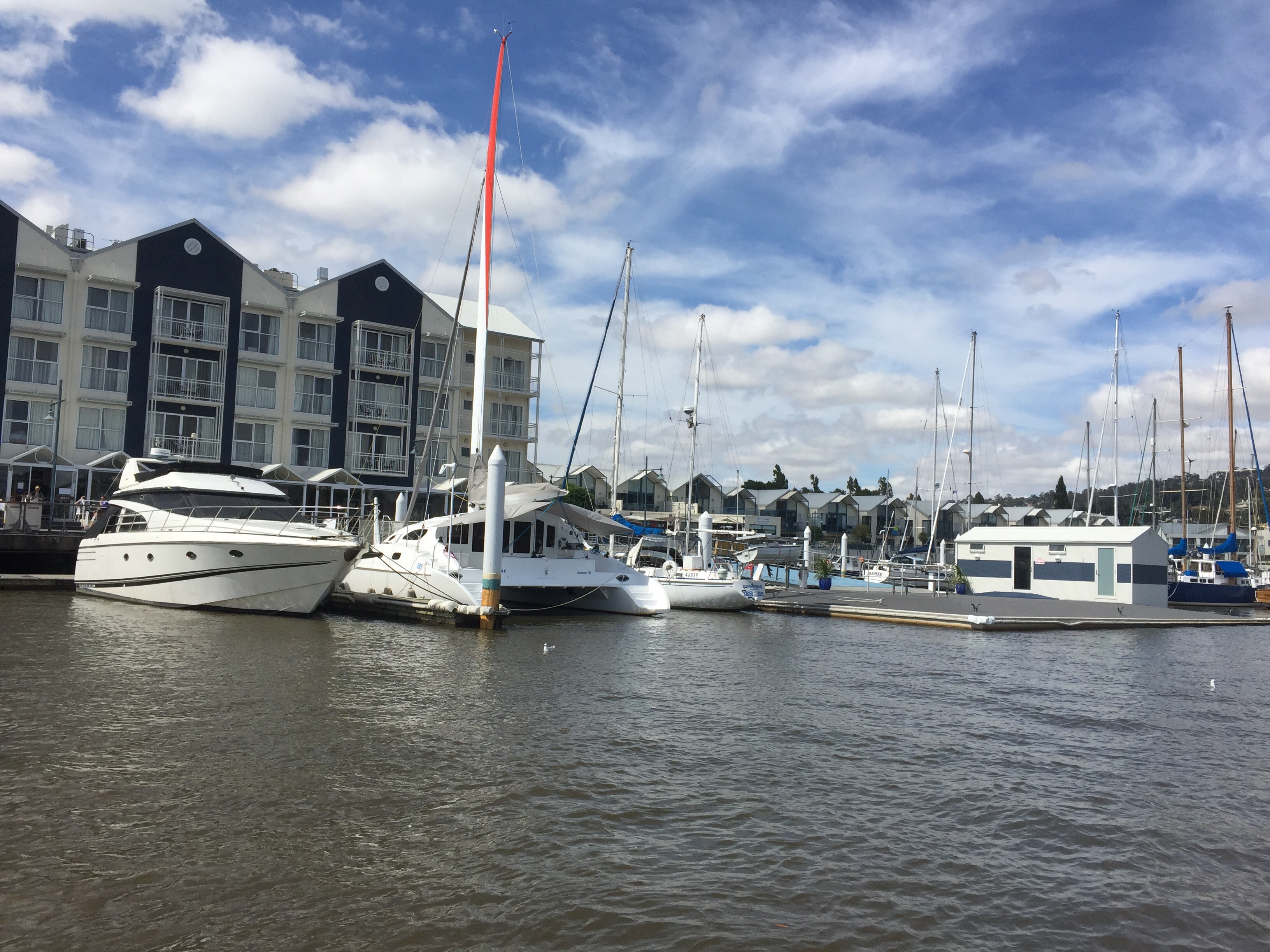
We were out and about early as we had to be at the harbour for 8.30 to catch the Harbour Master (the name of the boat) for our cruise out into the Macquarie Harbour and along the Gordon River.

There were a number of people boarding the boat, some as lower deck passengers and others,  like us,  who had opted for upstairs with a free buffet lunch.  It was a modern vessel with smartly dressed crew and catering staff.


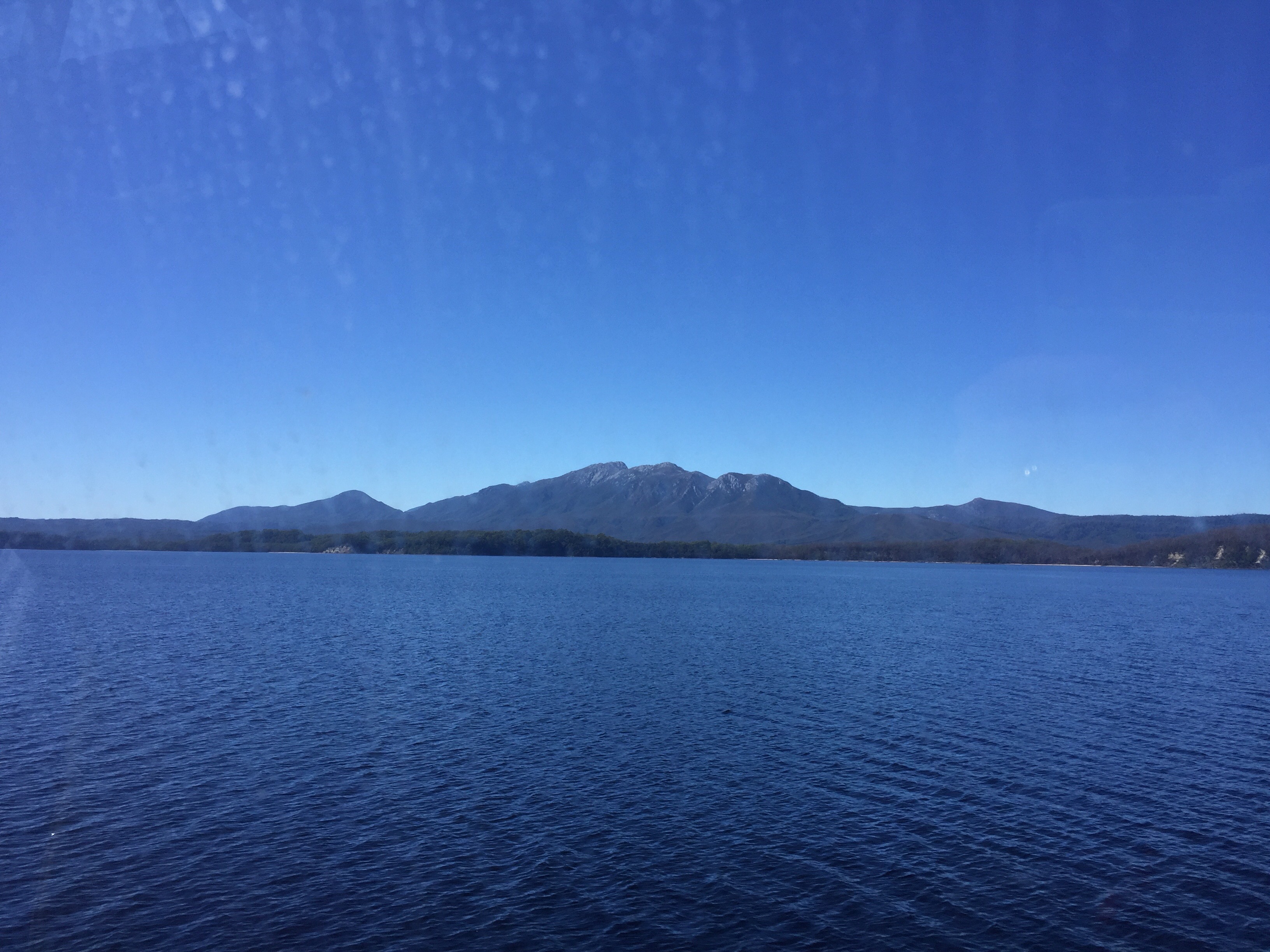
We pulled away from the jetty on the dot of 9.00 am, gathering speed as we moved out onto the clearly marked channel. After a bit of posing by the author,


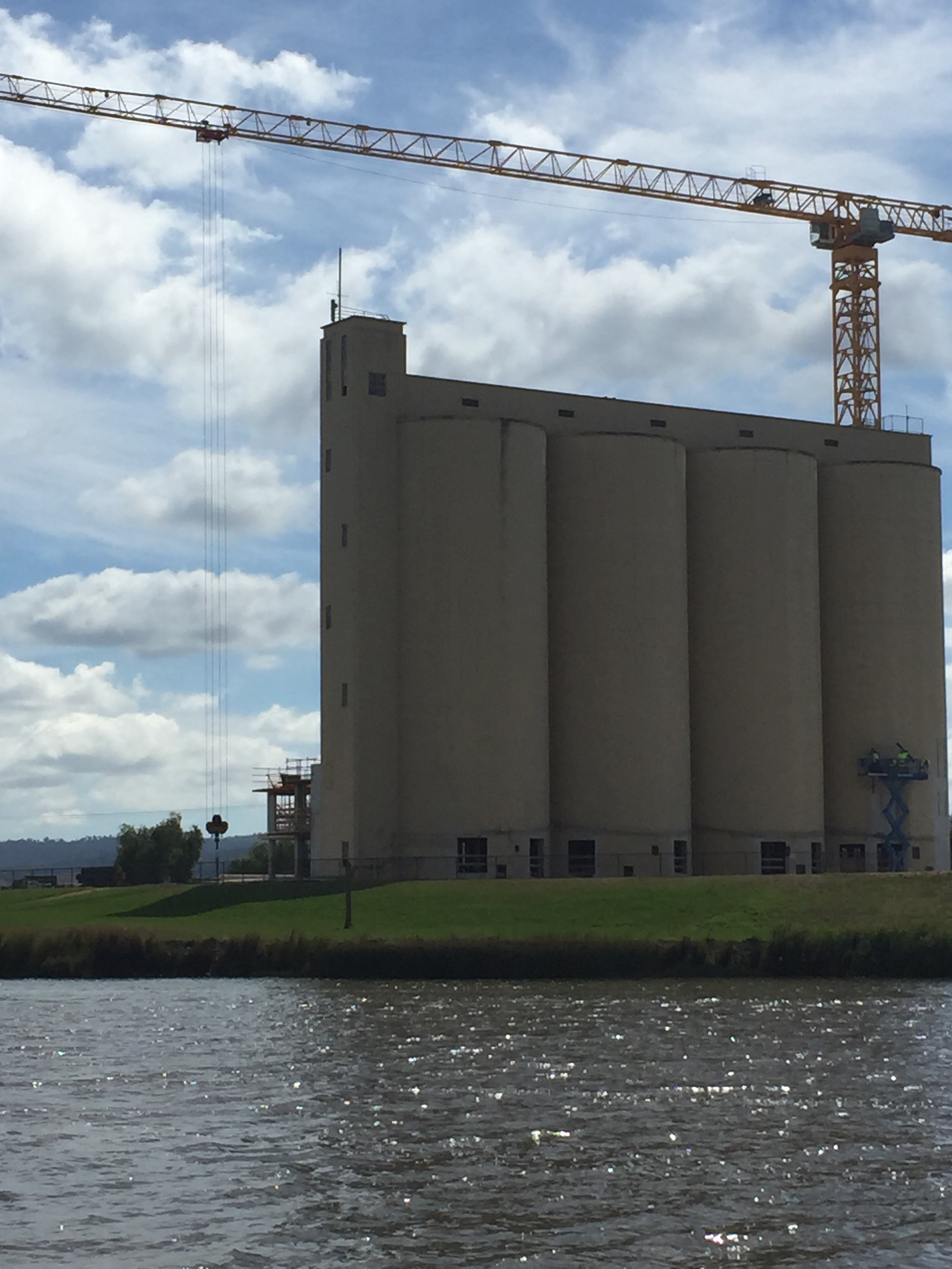
we settled down to business and descended from the top deck to get away from the sharp breeze that got up as Harbour Master (an odd name for a boat – as if they could not decide  whether to call it after a person or an office……).  I was equally concerned that after a short health and safety notice, we were invited to have coffee and ‘why not spoil yourselves with a dash of Baileys in it'(!!!) which sounded a little irresponsible to me at 9.00 o’clock in the morning…..  however.   Macquarie Harbour is bigger than Sydney harbour.  There used to be a passenger service between Strahan, Adelaide and Melbourne. As a port Strahan developed as a place for shipping the minerals mined inland.  It is now purely a fishing port. The prized abalone, that I personally find disgusting, is found in the waters.


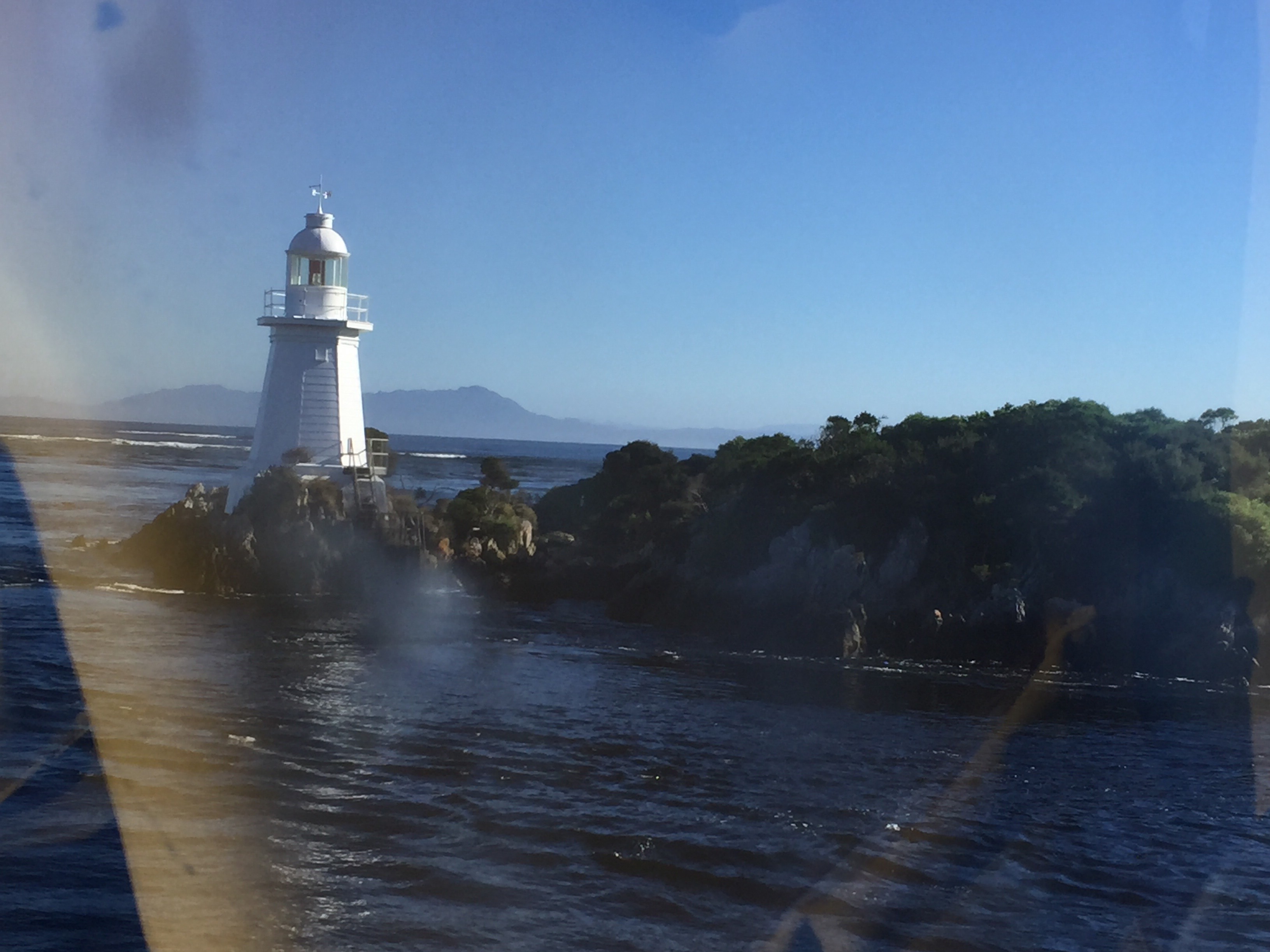
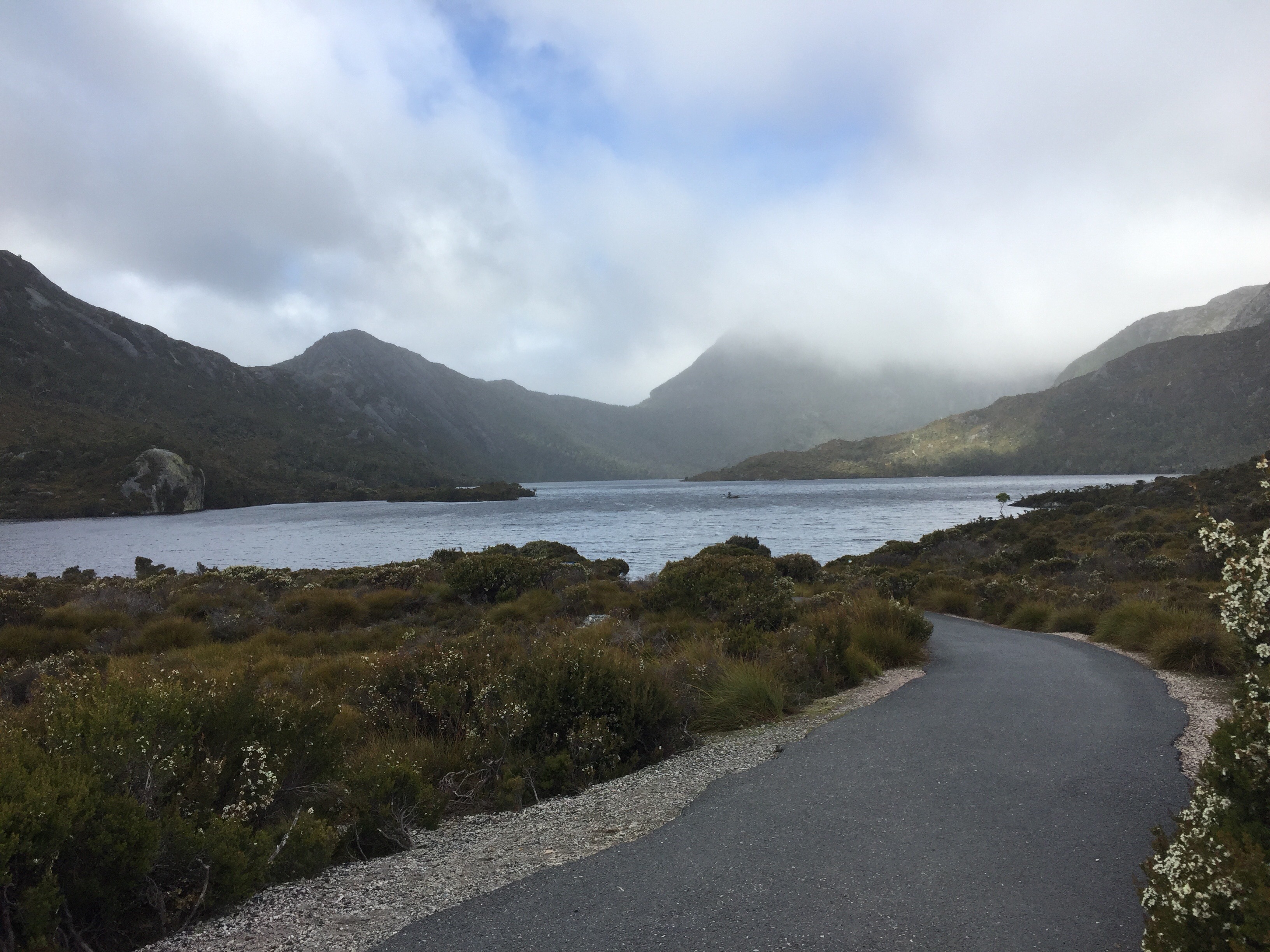
Macquarie Harbour has one or two problems, not least that it is a bit shallow.  It has a small challenging gap (I am sure this is not the nautical term for harbour entrances!) to enable a boat to get in and out of it and the weather. All have combined to lead to quite a few catastrophes and shipwrecks over the years.  Waves of 23.5 m have occurred just outside the harbour entrance. Talking of the weather, now might be an opportune time to mention it.  It has been fantastic.  To date we have had wall to wall sunshine – even in Tasmania where there is usually a lot of rain and in Western Tasmania 300 days of it a year.  (Good grief – think what that would do to the hair……)

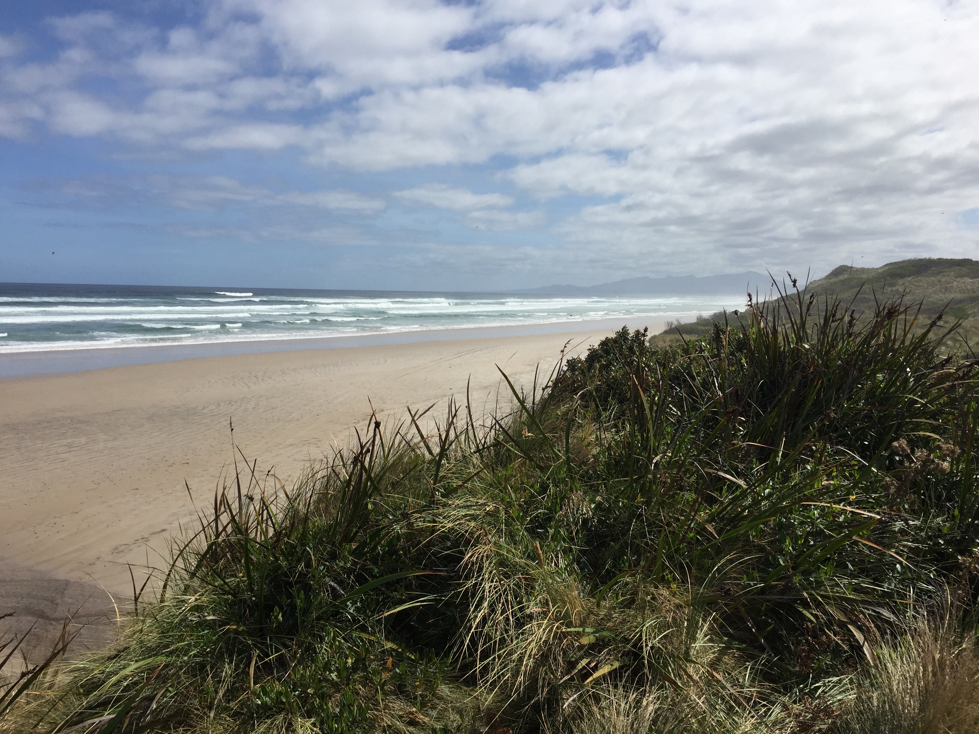
Anyway to get back to the tale.  We first cruised out of the ‘gap’ and turned right along the coast. Here the initial sandy cliffs gave way to the long Ocean Beach which we had visited on our way into town, seen this time from the seaward side!

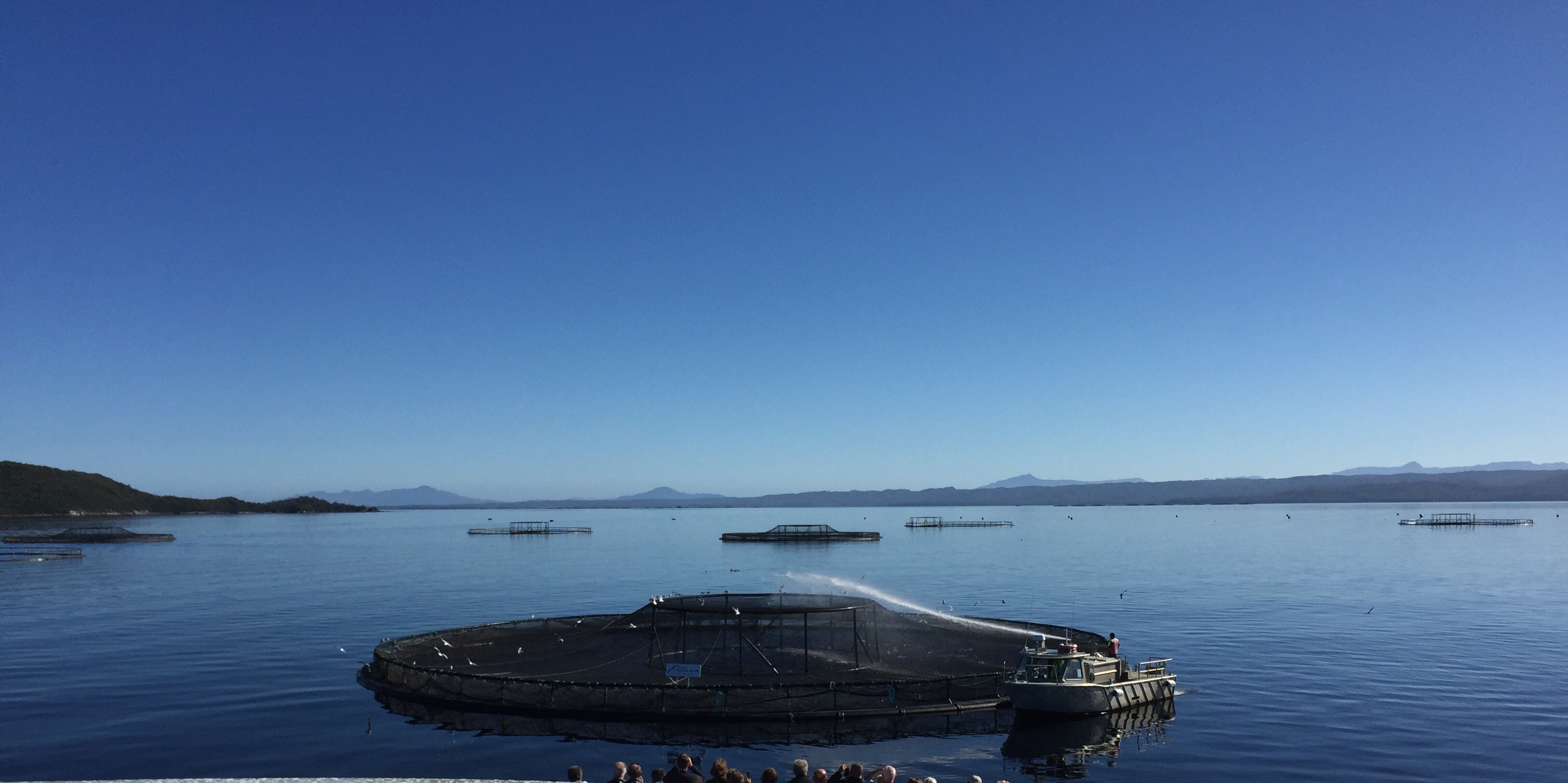
There are fish farms out in the bay.  Mostly farming salmon, they provide jobs for the local community. There were huge cages holding up to 30,000 fish each. They grow to full size in 18 months when they are collected on barges.  The biggest problems are caused by seals accessing the nets.


From the practical issues of today we moved back to the issues of the 1800’s.

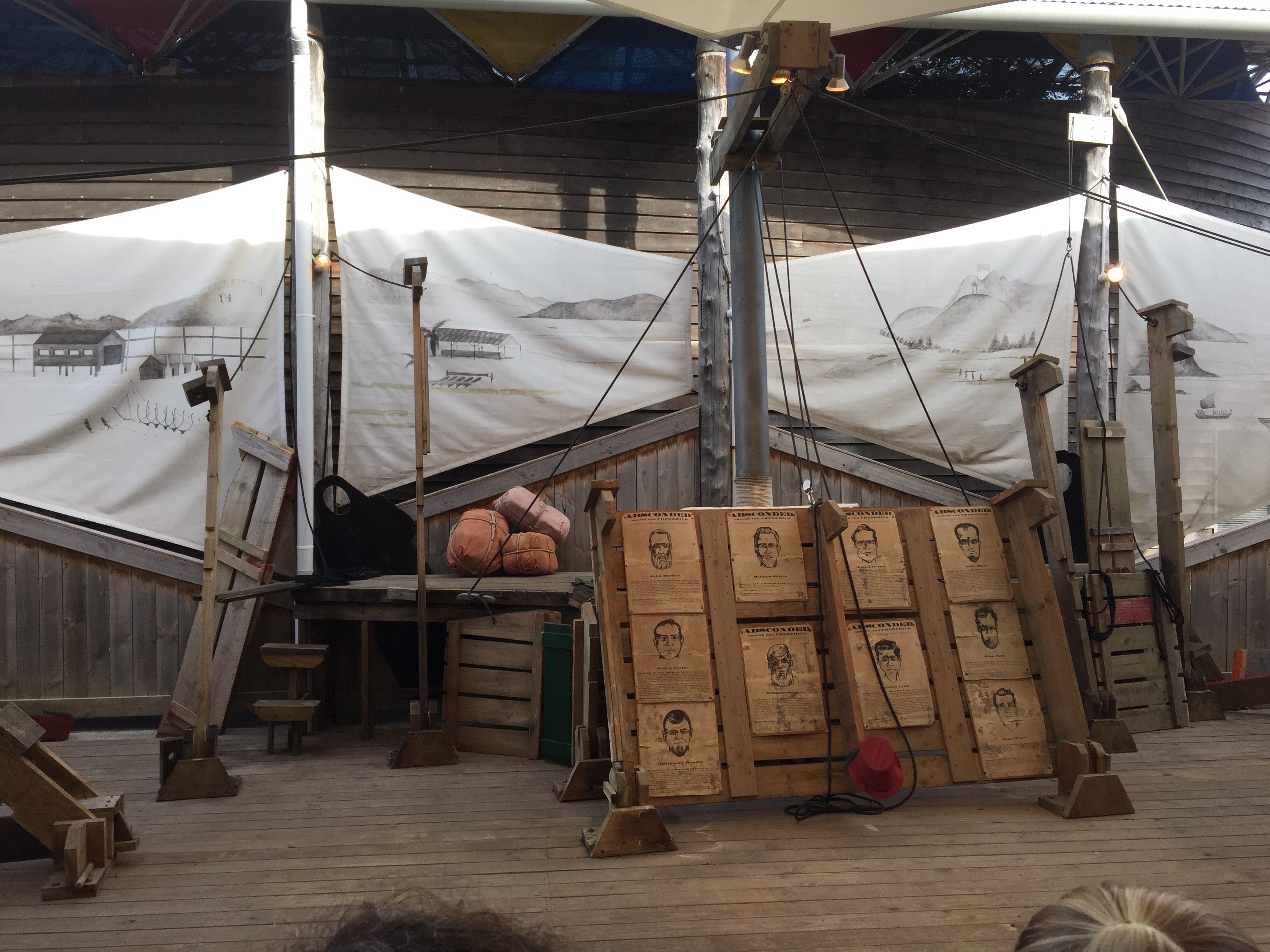
In 1815 Captain James Kelly became the first European to set foot on the now infamous Sarah Island within the harbour. (He named the island after the wife of the man who sponsored his trip – I bet she was thrilled given its reputation!) He had discovered the ideal location for a prison outpost.  Remote, surrounded by water, the nearest land an impenetrable wilderness and with an abundance of Huon Pine and  Celery Top timber – the wood that does not rot and ideal for making ships. Established in 1822 the convict station known as Settlemnt Island promised the worst fate possible for a convict.  It was the harshest of regimes. It was a place of dread and  fear. The entrance to Macquarie Harbour was called Hells Gate by those entering it en route to the Island.  It was the repository for the convict who had been sent to Tasmania or Van Diemens Land and had then re offended. The convicts were treated as slaves. The first Commandent was described as a ‘sadistic bully with peculiar qualities’ (whatever that may mean!!). He authorised 9,100 lashes in his time with something called the ‘Macquarie Harbour Cat’  which was much heavier than that used by the army or navy for punishment then. The Goal had cells 6 ft by 3 ft – the size of a grave. In addution to the prisoners, there was a military presence, a missionary and his wife and a surgeon.  A number of women lived on the island related to the military and officials.  For them all it was a sentence.

The wind around the island was so strong that a 12 m  palisade had to be built to act as a buffer against it.  The prisoners were initially employed felling trees in readiness for them to be shipped elsewhere, worked in the tannery, the blacksmiths or in the bakery.  Later it was found that it was easier to make the ships on the island rather than fell trees and then prepare it for shipping and shipyards were built. Latterly the ships built on the island were the best of any built at that time.

Life was so tough that there were many attempted escapes. Some were successful and some fatal.  Many of the escapees were caught, tried and hanged, or died in the attempt.

Whilst the life for convicts was grim and described as ‘unremitting  depravity, degradation and woe’ the close proximity of all on such a small island (2 miles in circumfrance) meant that tensions were also prevalent amongst the officials and military. There are tales of mysterious deaths and requests to be relieved of duties.

Later things improved but for 12 years Sarah Island was a living hell

Today, with the sun shining, it is beautiful…….

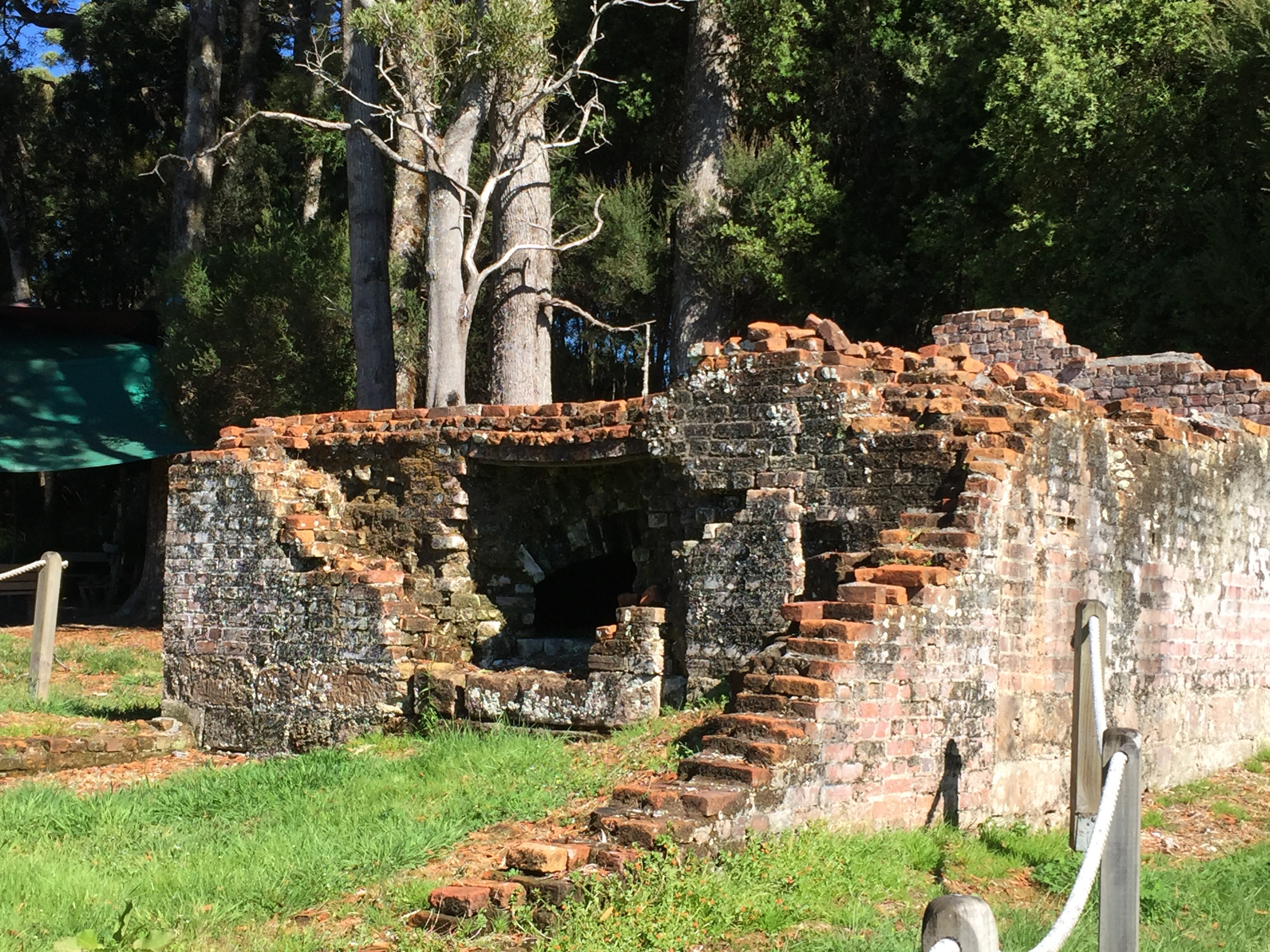
There is still evidence of the oven in which the bread was cooked …….

And what became the prisoners dormitory …..

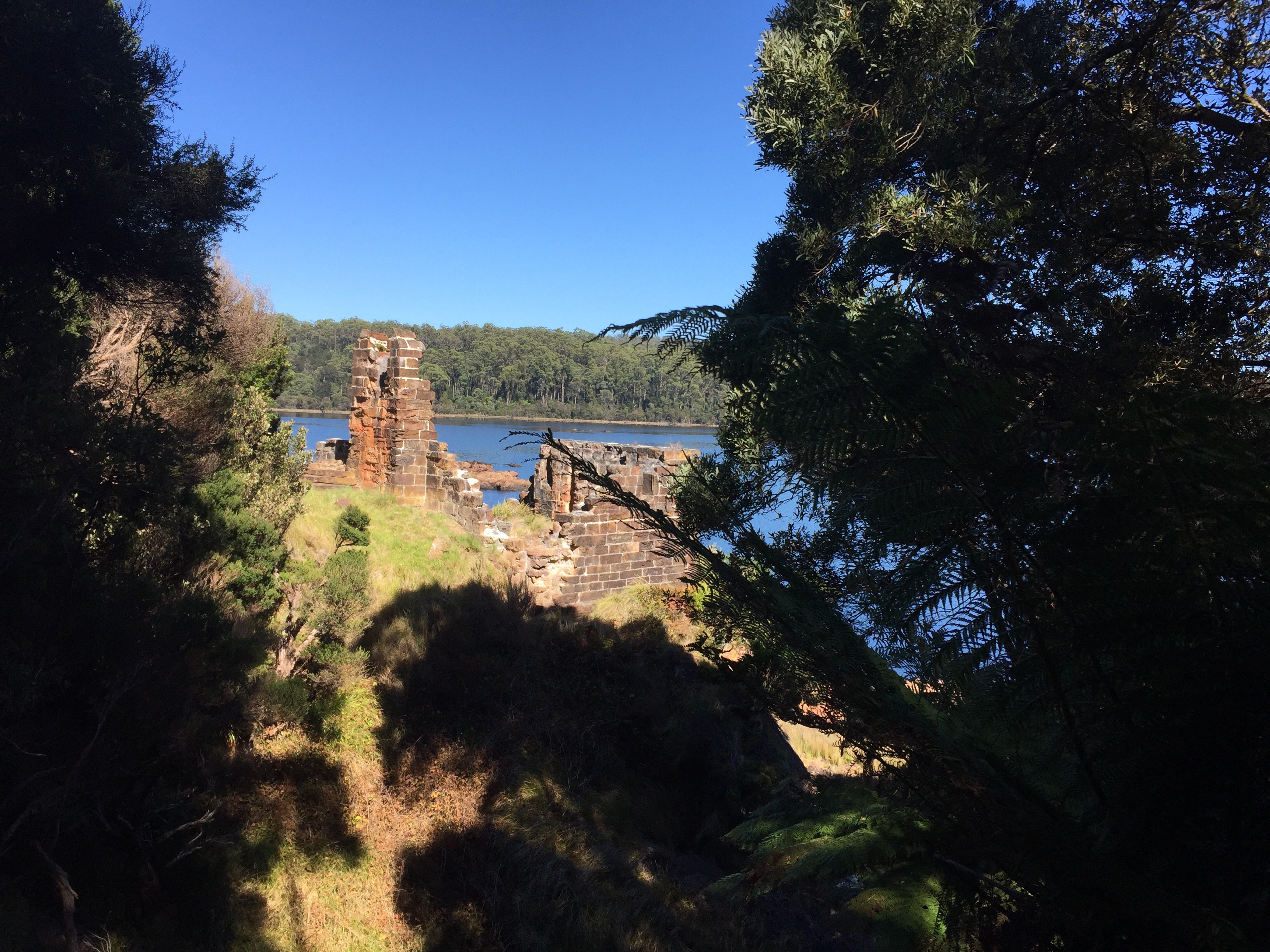
But mostly all evidence of the harsh times are gone.  The odd fireplace, the exterior walls of the Goal, but for the most part it has disappeared and the horror of the prisoners who lived there has been eradicated.

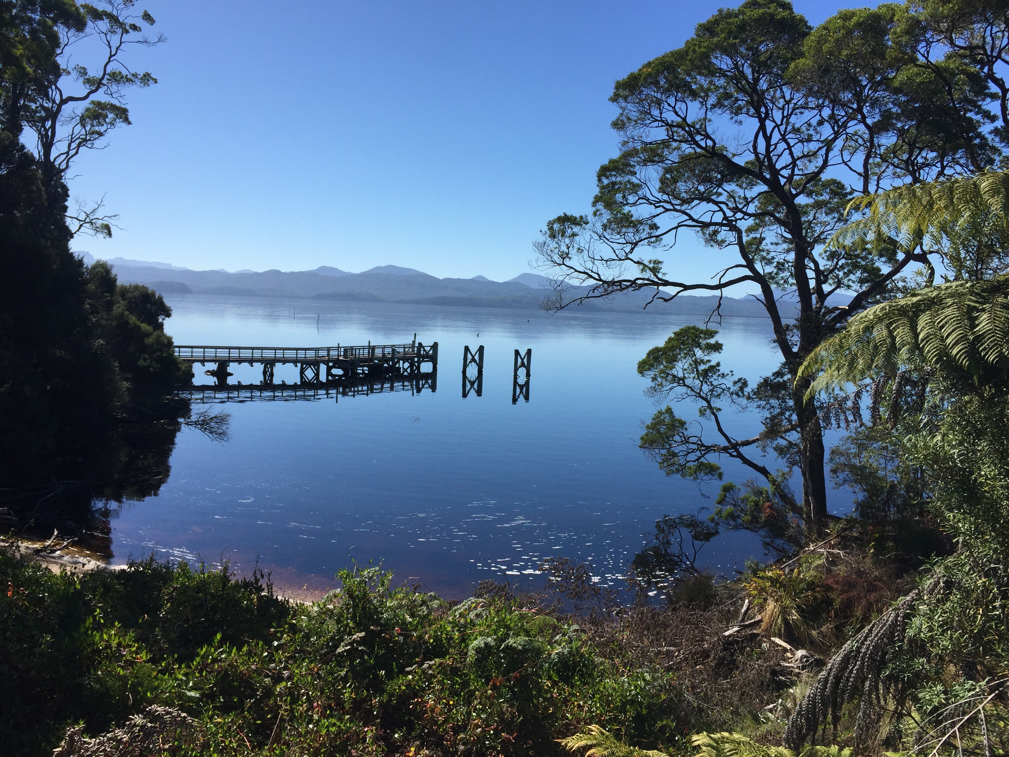
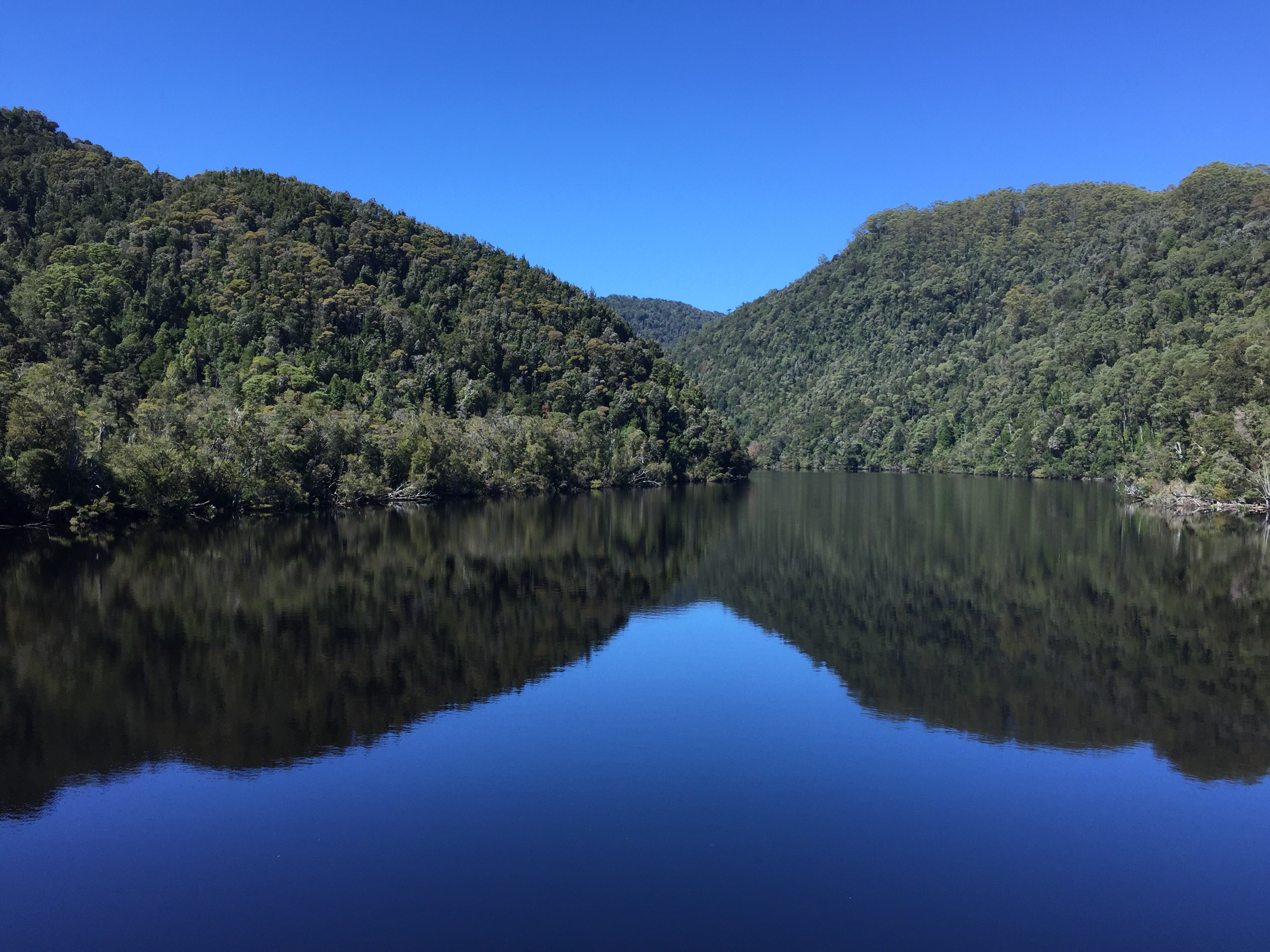
For us, after our tour of the island it was back on board for a bottle of champagne and lunch.  Our tour continued up the beautiful Gordon River and then back to Strahan. It had been a beautiful trip and one never to be forgotten.


It was then home for a siesta and then another great supper.

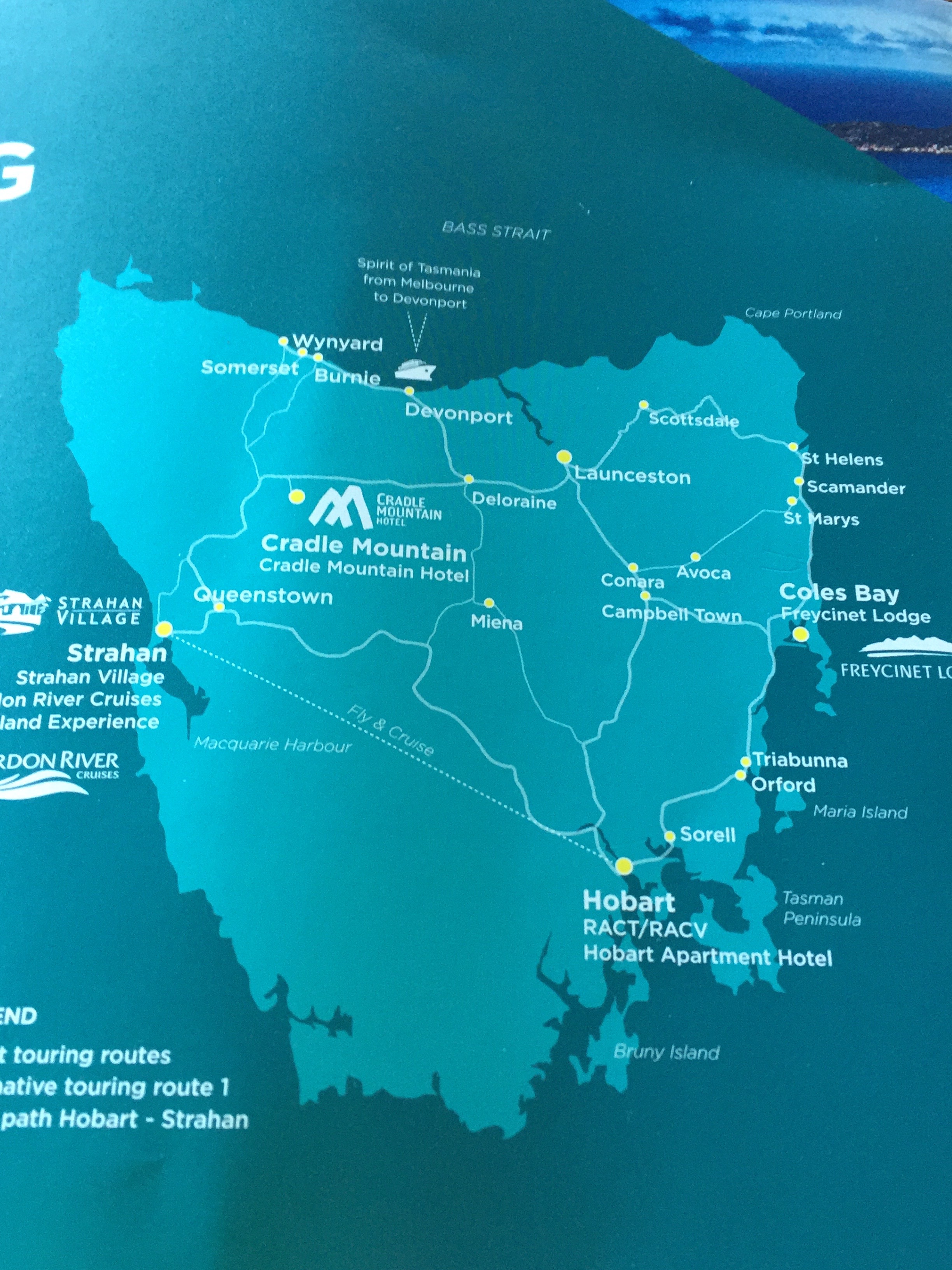
Tomorrow we head to Hobart!

Sunday 26th February

The morning saw us packing our things together again, it was time to move on. Our destination was Strahan, pronounced ‘strawn’ locally.  A small town on the west coast, Strahan’s Maquarie Harbour incorporates the infamous Sarah Island, said to be the most horrendous of penal settlements. It was the destination prison for convicts who committed offences while under sentence. More of this later…….
The route to Strahan took us out initially through the rainforest of Table Mountain and then through an extensive mining area. Minerals, tin and even silver was mined  in this sparsely populated  wilderness.  Occasionally there were small, poor settlements. There was little sign of life anywhere. Sunday still seems to be observed as a rest day in Tasmania.  

We stopped at a town called (rather exotically I had hought) Zeehan. Unfortunately it now shows littlr evidence of its previous rich history. There was no one around. A couple of rusting steam engines indicated communication links to the outside world. A children’s playground looked abandoned from lack of interest. A sign in a shop window seemed to sum the place up. 


 Abandoning thoughts of a drink top we pressed on to Ocean Beach, 35 Km’s in length and the longest beach in Tasmania. The beach was deserted except for some large horsefly types that hastened our decision to find our accommodation.  


This proved to be an amazing colonial type house on a hill up behind the harbour. It provided beautiful accommodation, with a veranda both front and rear. 


 Keith and I wandered down to the town to see if a lunch out could be found. It couldn’t! So we turned back up the hill, bought a few provisions for supper and settled down for a lazy afternoon prior to the play that we had heard was being performed at the back of the Quay.  

At 5.15 we headed down to take up our seats at the open air theatre kitted out as a ship of the 1800’s.  What then ensued was a riotous romp through a famous tale of the Sarah Island Penal Colony involving two actors, much audience participation and a rather incredible piece of scenery which metamorphosised from what looked like a harbour scene to a full scale ship.  It was hilarious and in an hour and a half told the tale of convicts who took over the ship they built as part of their slave labour on the island, sailed it to Chile (the next piece of land west of Strahan) where they lived for a year before bing brought back to zhobart for trial.  The were condemned to death, but were in the end reprieved on a technicality!  It was part pantomime, great ntertainment and educational.


After a good ‘belly laugh’ we set off back up the hill for supper and to bed. Tomorrow we cruise… ……

Saturday 25th February

It had fallen to me to choose the day’s walk. Having looked at the options I thought the Dove Canyon Circuit fitted the bill nicely. ‘This 5km Circuit crosses buttongrass plains, open forest and myrtle rainforest to the deep gorge of the Canyon. Numerous waterfalls on Pencil Pine Creek, including Knyvet Falls. Some short steep climbs and descents. Some sections which are rocky, muddy and could be slippery.’ Fair enough. Not outwith our experience and similar to the previous days walking……. Now here’s the thing – my advice now is never to take a walk where gorge, canyon and ‘rocky’ are involved in the same description. We found out the hard way – by doing it 😳

The day started well. It was warm and sunny and not the showery day predicted. As a warm up we took the car to the Rangers Station where we had ended the previous day’s walk and did the 20 minute Enchanted Walk which meandered through very pretty woodland beside a stream after a very impressive water fall. Very nice.  


We then crossed the road and took the signed route of the Dove Canyon Circuit, with an estimated time of 2 – 3 hours. Alarm bells should perhaps have rung then at this length of time for a 5km walk. However, undaunted we set out. We first took a short detour to see the Pencil Pine Falls. 2 minutes each way. Lovely! 


 Then back on track we picked up the forest walkway to Knyvet Falls. Very nice.


 However, having walked for a good 20 minutes, the sign for the Canyon Circuit was saying 3hours….. for less than 5 Km’s.  Very worrying but we set off in good spirits. 


At this point the wooded walkway gave way to a narrow stony path. We walked just above the stream as the path gently climbed and descended. The danger of tree roots made looking around a bit dangerous but all was good. Eventually we started to climb up a rocky path, a bit damp in parts, but we eventually came out onto a bit of a plateau of button grass. Occasionally we could hear the throb of the helicopter from the Visitor Centre flying overhead. There was no wind – the only other sound was that of the water moving over the rocks below us. It was a beautiful still summers day.  


The next up was more difficult. First through trees and then over rocks that ran along the back of a wooded area. The path was definitely getting more difficult. It was about here that we met a couple coming the other way who said we were in for some fun ahead and what they described as a path that involved a bit of ‘scrambling’. 😳🙄💡😨⛰🏔 We had definitely not signed up for scrambling! As the route behind us would not have been a good one to walk back on, we all agreed that they were exaggerating, laughed a bit and continued on our way.   

They were not exaggerating. The path turned inward towards a wooded escarpment which we continued to climb, to the point that the roots that had initially been problematic underfoot alternated between being handy toe holds or useful handles to pull yourself up on. Occasionally we came out of the trees and into a clearer area. To our left the rocky outline of the lip of the gorge could be seen, the sound of the water crashing below us could be heard clearly but was not visible. 


Towards the end of a woodland section was a sign that said we would coming to the top of the cliff edge and that ‘care should be taken with children’. I am not sure that anyone in their right mind would have undertaken the route we were walking with children in tow! It was as much as we could do to get ourselves up the steep incline. The going then got really steep, but we eventually came out near the edge of the rocks. Once again the water could only be heard below but the cliff was too sheer for us to see it. The rocks on the other side of the gorgethe were quite close.


 There was a wire fence of sorts reminding us not to go too close to the edge (particularly with those children, I guess!). After a short time our route turned us away from the edge and we thought we had reached the highest point and were over the worst. We were wrong. The ‘path’ took us up through a very narrow crack in the rocks. We were ascending again, steeply. 


A little further on it was impossible to walk and we were climbing! It was hard work and not a little frightening as we worked our way slowly upward. We kept thinking we had reached the top and then found we had another top to reach, but eventually after coming down slightly we reached the sign going the other way about the cliff edge and children, so we had passed the worst. ….. please note that there are no photographs of this section – I was a bit busy staying alive and not falling on my compatriots!

Shortly afterwards, we reached the trees again and entered a silent forest. It was lovely. The light was muted and a clear blue sky could be seen above the tall trees. Heaven! A couple of currawongs followed us for a bit. We meandered along a path that was not always clear – unusually. Most of the paths we have followed in the national park have been clearly sign posted. It was here particularly that I thought about what I had read about aborigines in the area. Apparently, an English chap decided to send all the aborigines that they found off to Robinson’s island for a programme of ‘civilisation’. Many of them were transported there and then, the report said ‘the final family were captured twelve years later’ I could imagine an aboriginal family hiding in this silent place, terrified of these white men who hunted them like foxes. Another not proud moment for the British. Before ‘our’ arrival, the Cradle Mountain was on the travelling route of tribes of aborigines who hunted and fished in the area.  

For us, real relief came when another section of boardwalk appeared. It was fairly short lived but by now we were back into buttongrass and the occasional rotting tree. Some spectacularly.


 Now we could see the ridge of Cradle mountain on the horizon and we knew we were close to the boardwalk area we had walked yesterday. 


 In about another 10 minutes we had reached the cross path. We had made it safely back. It took another twenty minutes or so to get back to the Ranger Station but this was mainly down hill and very pleasant. 


 Despite the dodgy moments we had achieved the walk, but felt the challenging nature of it had not been clearly advertised or perhaps we had just not taken what it said seriously enough…….. either way, no-one had died (thankfully!) and we had had a great insight into the rugged landscape. I think we felt quite pleased with ourselves that we had been tested and met the challenge.  

We had our lunch when we got back to the Rangers Station and felt it was well deserved. After a quick trip to the Visitors Centre it was back to no 26 for a shower and siesta. We had a night with the nocturnal animals ahead!

At 8.30 the bus picked us up for our evening with the animals.  The local marsupials are nocturnal.  Greg the driver shone light beams into the grassy verge as we left our accommodation park and there before us were paddy melons (mini wallabies – I think!), wombats and wallabies.  During the evening we also saw one or two possum. I was amazed at how many animals we saw.  A veritable hotspot for marsupial night life!

As interesting as this was, our main port of call was the Tasmanian Devil sanctuary. This little creature gained its bad reputation and its name from the early settlers association with.  It sounds constantly irritable and aggressive opening it’s pink mouth and baring its teeth to snarl menacingly at the slightest provocation.  The English, and European for that matter, had not come across such a creature.   As the devils took to  living under the new settlers houses, It must have been somewhat disturbing and understandably caused some alarm and displeasure.   Hence the name.   As half grown devil chaps romped  around a big enclosure they looked quite cute.  When their night feed came in, in the shape of a dead wombat, there was no question that they are quite ferocious!  They eat literally all the animal – the fur to provide the roughage they need as they are totally carnivorous we were told.   At a distance we could hear them crunching the bones of their supper.  Every now and then a little devil made a dash for freedom with a piece of booty clenched between his teeth.  There was a constant yanking and tearing, growling, yappng and snarling until nothing of the meal remained.  What started out as a whole dead animal was totally consumed 

75% of the population of Tasmanian devils in the wild suffer from a disease called devil facial tumour disease.   This is a cancer peculiar to the devils and transmitted through their jaws during their constant fighting and bickering.  Places like the Sanctuary set up quarantined communities living a similar to wild experience to prevent the specie dying out like the Thylacine,  the Tasmanian Tiger  striped nocturnal dog like predator that disappeared at the beginning of the 20th centuary.  To date no antidote has been found for           The Devils fatal malady and their only hope of survival is the breeding in captivity being carried out on various places on the island. 

The next creature was the amazingly marked quoll. This is an animal that neither Keith or I had heard of.  Considerably smaller than the devil, more like the size of a small cat, the quoll is another carnivorous of the area.  Their colourings went from shades of beige through to black with beautiful spots, making them almost camouflaged in the dappled sunlight of the rain forest.  They were pretty little things with long snouts but equally ferocious when confronted with raw meat!!


Following our visit to the sanctuary and a comprehensive commentary on the two animals being nurtured and a very interesting commentary there by a young and very enthusiastic keeper, we left at about 10.00 to observe further late night grazing activity by the local marsupial population.  It was fascinating!

Ironically, we probably got the best sighting of a possum on the walk back to hut 26 in the discovery park – we had a bush tailed possum walk right across our bows!  

Friday, 24th Febuary

Cradle Mountain was first visited by European explorers in the 1820’s and prospectors and hunters searched the region well into the 20th century. However, it was an Austrian immigrant Gustav Weindorfer and his wife Kate who were instrumental in the process of the recognition of the area that led to it becoming a National Park. Its vegetation is described as a mix of rainforest and alpine. There are conifers (King Billy pine and pencil pine) and southern beeches (myrtle and deciduous beech).  I felt very pleased with myself that I spotted the myrtle.  
There are a number of walks around the mountain and we checked in at the visitor centre to register our presence and get our passes to take the Cradle Shuttle bus to start our walk. We opted (on Helen’s advice although she was not present) to walk the Dove Lake Circuit. This is a 6 Km walk around the lake with Cradle Mountain looming overhead. We took the second shuttle bus – the queues were amazing – none of us expected the crowds! However, amazingly, within minutes of setting out on the path, we were on our own! We could not work out where everyone disappeared to. 


 The path was clearly defined, with alternating stony track and boardwalk. It made easy walking through the rainforest terrain,  which felt prehistoric. To our right the lake looked freezing cold. It was very grey and overcast. Cloud hovered over the mountains above us. To our left large rocks were interspersed with the snarled trees which covered the steep escarpment. Eucalyptus trees, shedding their bark and cutting grass, with its sharp edge, lined the path. Occasionally we came across a sandy section of shore line.  Every now and then a strong gust of wind swirled between the branches of the tall trees, rattling the grasses and strips of sloughed bark. There was a strong sense of walking through an ancient landscape. 
We entered an area called Ballroom Forest. We could not quite work out the title, but the ancient trees here were gnarled and twisted, often covered with moss. 


A stream appeared running down to the lake and a smart bridge carried us effortlessly over it. Leaving the forest we moved into more open land. Our path took us up and down. At one stage a currawong appeared, a black raven type bird with bright yellow eyes. We realised that he had his eye on Keith’s apple. It followed us along the path to the lake edge and wasn’t happy until he was given the apple core.

Our path took us up and away from the lake. The boulders here are silver grey with green lichen – gone are the red boulders with the orange lichen in the heat of the northeast of Tasmania where we walked only a few days ago……. This is different. It is an alpine region where the weather can change frequently – an hour can apparently see the weather  move between sun, high winds, rain and snow. It had a strong feel of the Lake District in England.  

We were now on the opposite side of the lake to where we started. Gone were the thick forested areas. The terrain had opened out. Behind us the mountains soared, still etched with cloud. Occasionally the clouds parted and the sun came out and shadows danced along with us. Ahead we glimpsed the car park in the distance. Eventually we came to the boat house we had seen from the other side of the lake.


 We were nearly back to the car park and we realised what had happened to all the people – they obviously come out to the shorter walks e.g the boathouse, and then go back!! Various paths went off to the left, including the three day Overland Track (not for the faint hearts!!) but we were soon back at the car park. 

Having consumed our packed lunch, we decided to set out on another track, heading our way back towards the Visitors Centre. To do this we took the route to Ronny Creek via Lake Lilla. This took us across a long board walk area, this time covered in buttongrass moorland. These pom pom shaped grasses cover the meadow type area of the landscape. 


 There were square shaped droppings on the boardwalk which we subsequently learned was evidence of wombats. It appears that they don’t like getting their feet wet and use the boardwalk to keep them out of the boggy ground. Eminently sensible! 


 We crossed another water channel where another large, almost succulent broad but spikey leafed plant that obviously liked water followed the waterway into the distance. I thought they looked like a group of hippies bobbling along the riverside.  Here there was a cross path, but we continued to head to Ronny Creek. Our route took us across the road of the shuttle bus to the other side of the road. The information board indicated it was another two hours from there back to the visitors centre. We all agreed we were up for this, so off we set. 

The boardwalk followed the road initially but then departed from it. We were in open buttongrass meadow country again. We followed the boardwalk which enabled us to build up a rhythmic pace of the wire mesh covered wood. It was perfect walking, with occasional steps to accommodate the rise and fall of the territory through which we were travelling. Now and then we crossed a wider waterway by a bridge.


 Every now and then there were stands of the silver grey ‘dead’ treessometimes twisted into grotesque shapes as if throw their death throes had been tortuous. Often the silver trees had fallen to the ground and were being eaten away and reverting back into the soil. The words dust to dust came to mind.  


The girls left us about half way along the path at a point called Snake Hill. This was a pick up point for the shuttle bus so they were able to hop on a bus quite quickly. We continued the walk for another hour. Occasionally alpine type plants covered with flowers appeared. 


The scenery, apart from our wooden walkway that showed up as white as it snaked ahead of us towards the horizon, was probably very similar to the way it had been for thousands of years. Amazing. 

We eventually arrived at the Rangers Station which marked the end of the boardwalk. From here we had a 1 1/2 Km road walk to the Visitors Centre to meet up with the girls. On the way, to our great delight, we came across a wombat grazing on a bank by the side of the road. He was totally engrossed in his munching and not at all bothered by two grimy English people pointing their cameras at him!


At the Visitor Centre we found wendy and Sarah again and were soon back in hut 26, our current address. We had thought of doing an evening excursion to see the much heralded Tasmanian Devils but deferred this until Saturday, a good idea as it turned out – we all adjourned to bed before 9.00!  This fresh air is heady stuff – a couple of glasses of wine and a great meal could have been another contributing factor!

Thursday 23rd February

Our last morning in the little town of Launceston (population 80,000).  Bad news this morning.  A family crisis had arisen over night for Helen that meant she felt she had to leave us, at least for a few days.  By 9.00 am she had left for the airport and was gone.  And then there were 4.  We were very sorry to see her go……..

We packed up and were ourselves gone just after 10.00. First stop was the town to take on supplies.  Cradle mountain is going to be quite spartan by all accounts.  As rain was forecast for the area to which we were  ultimately heading, we decided to detour through  the Tamar valley wine country to make the most of the sunshine.  This meant a route to the right hand side of the Tamar, which becomes a broad waterway as it leaves Launceston behind. (Authors note: In my previous reference to the Tamar I referred to it as the longest waterway in Australia, thanks to Jenny Wightman I now know it is the longest waterway in Tasmania.  Thanks Jenny!) it  was a green and pleasant land of fields and trees.  As always, there was very little traffic. 

We had decided to stop at a vineyard that advertised food to incorporate a lunch srop with a wine tasting. The Leaning no Church Vineyard seemed to cater for all our needs – and so it proved! 


 The wine on offer was good and the food exceptional. Keith and opted for a shared platter of local foods which was excellent and Wendy and Sarah had scrumptious vegetarian dishes.  Keith and Sarah washed theirs down with a sparkling white and I, very unusually, opted for the Chardonnay which I thought amazingly good as a non Chardonnay drinker.  We sat under the shade looking out onto the garden and had a thoroughly good lunch. It was delicious!


Having inspected the ‘leaning church’which showed absolutely no sign of being off centre, we took to the road again, crossing country back to the Tamar. Once again we moved through wonderful countryside. We reached the river and crossed the bridge and drive down to a place called Dolerain where we had been told there was a good bakery.  There was. We picked up an excellent loaf even though it was late in the day. 

It was an interesting town. There were a lot of arty shops – being run, it seemed, by aging hippies.  I described it as having a feeling of Glastonbury without the joss sticks!  There were some very odd sculptures about the place on black plinths……. e.g. Hmmmmmm….


Taking our leave of Dolerain, we headed to our final destination.  Cradle Mountain.  As we neared the area a long ridge of mountain range rose up to our left.  Trees seemed to grow up to quite a height.  Gradually the road became more twisty and as we climbed up.  There was dense, lush forest either side intially, but this gradually became more open with a lot of dead trees on the ground as though efforts were continuing to clear the area.  There was no sign of the expected rain.  So much for our detour to to avoid it!!

We eventually arrived at the Discovery Park lodge site. We booked in at the reception and arrived at our home for the next few days, hut 26 .  It was compact but very clean.  Helen, had she been with us would have had a little bunk over one of the double beds.  Cosy!!

Having unpacked our provisions we settled down to our first evening in our new home – it was quite warm as we had the heater on full but quite chilly outside. .  Temperatures were due to go down to 4 degrees overnight …… 

Wednesday 22nd February

After considerable debate, it was decided that the group would split for the day’s activities.  Keith and I decided to go to Launceston town and it’s surrounds.  It was the right decision!

The girls gave us a lift to town and we visited the tourist information centre who provided a map and hot tips on what to see.  First up it was the park after a little retail therapy for me ( well,  it is going to be colder on Cradle Mountain than anticipated……). It had a very Victorian feel with a children’s fountain and bronze statues.  We particularly liked the statue of a chap called Ronald Campbell Gunn, a self taught botanist, who introduced Tasmania’s natural history to the world it is said.  It was a wonderful sculpture From here we walked down to the river towards the wharf.   We passed the Boag Brewery, founded in 1831.  It is still going, but now has a modern extension.  Launceston was obviously a very wealthy town. It was rich in minerals, shipped grain and milled flour to England and Australia and ships could get from the coast down the Tamar River to the town.  This wealth was reflected in the Customs House which stood proudly overlooking the River. 

We wandered on towards the the dock and eventually came to the jetty where we could join a short boat trip and so boarded the Lady Launceston, a small pleasure boat captained by the wonderful Geoff.  There were only 12 of us on the trip – but we learnt so much!
We set off from the wharf, recently renamed the Seaport.  Three rivers join at Launceston.  The north and south river Esk which come together at the point they meet the Tamar. The Tamar flows out into the sea at Strahan on the north coast of the island. (Please consult your maps!)  It is this facility to accommodate shipping travelling right into the heartland of the island that made Launceston such a success, as it meant that ships could reach the source of grain, beer and the minerals and take it to the Australian mainland and elsewhere.  In early days Launceston supplied the large numbers involved in the gold rush. At 70 Kms the Tamar is Australia’s longest waterway. 

As we meandered around the harbour, young Geoff supplied all sorts of facts and figures about Launceston. Around us exotic quayside apartments and houses came into view contrasting with something of a graveyard of shabby shipping, including an old Hong Kong ferry (somewhat off course!).  Houses covered the steep hillside overlooked the river, many of them quite old.  Apparently wood lasts very well in the climate of Launceston as there are no white ants, the arch enemy of old houses in Australia. Building on the hillside became possible once the Kings Bridge had been built across the entrance to the gorge.  It is certainly a very smart bridge, a prime example of Victorian engineering. 

The bridge was more impressive than the thought of the current plan to make the old grain silos into hotel – I hope they put a few more windows in!

We passed under the bridge and continued up the gorge to the sound of – we could not believe it – the bagpipes again!  There,  high above us, stood a small building housing a lone piper!  We are obviously particularly blessed!

At this point the boat turned around and our boat trip ended.  Deciding to investigate the gorge further, we walked across the bridge and took the pathway along the gorge’s cliff edge. As the water of the gorge got shallower, it gushed over rocks until it eventually ended at yet another Victorian delight – the gardens!  A whole swamp area had been drained and laid out as a Victorian promenade – complete with bandstand and peacocks!

It was here that we met up with our chums again – not planned but very pleasing.  After an abortive attempt to have lunch (one lacklustre waitress was not going to feed us before nightfall we thought!) we abandon the attempt and decided to go to the races!  We had arrived on the day of the Launceston Cup – an event that closes many of the shops and restaurants of the town and is obviously a very high spot in the Launceston social calendar. Wendy and Sarah declined, but a very under dressed trio (as it turned out) of Keith, Helen and I set out.  It was great fun!

We arrived at the race track to find an event that would not have shamed Royal Ascot!  Amazingly attired ladies strutted about on incredibly high heels ( did they not know that grass would be involved?!) with fantastic hats and wonderful designer dresses. The men were on the whole less formally attired – in fact I came across a new concept – men with bow ties and braces wearing shorts!  Interesting. It was a fashion parade of the first order and I felt somewhat conscious of the walking sandals, shorts and t shirted figure that was me, but undaunted we bought a glass of champagne, placed a couple of bets and took a seat in the stand overlooking the winning post – and my horse won!!!! I have to acknowledge that Keith had identified the horse (I think his knowledge comes from a misspent youth!!) and showed me how to do it…… I have to report getting quite excited as Pateena Arena crossed the line!  I won the whole of 27 Aus dollars.  I don’t think it will be a large part of my retirement and I think Lingfield will not form a large part of my future…..

I do think the bookie was somewhat surprised when the paparazzi of Helen and Keith insisted on photographing the handing over of the vast winnings!
Flush with success we decided to call it a day……. quit while you are ahead is what I say.  

The girls came and collected us and it was back up to our apartment on the hill for a wonderful meal produced by Keith and Sarah.  We dined royally overlooking the Tamar and drank champagne to note our visit to Launceston.  

Tomorrow Cradle Mountain!

Tuesday 21st February

I woke up as the sun rose. It was the day of the long walk and we were leaving Bicheno, so we were up early, packed and on the road by 9.00.  Our journey to the Freycinet National Park took about 40 minutes. We bought our day pass and started out for the Wineglass Bay lookout by 10.00.  There were a lot of people around – far more than we had expected as it is very late in the holiday season here.  We were intent on walking the Hazards Circuit, not a very long walk but it was anticipated to take about 5 hours because of the terrain.  Many of the people setting out were likely to take the route up to the Lookout and then back.

The path meandered upward initially.  People walked at various paces on a path that was a combination of steps, rocks and wooden bridges. The route twisted and turned through the trees and overhanging boulders.   On the way we passed a wallaby snuffling around obviously unperturbed by the people passing. 
Before long the lookout point was reached and Wineglass Bay became visible below – it was the stuff old Bounty bar adverts were made of!  


Turning back down the path, we turned off and started on the route that took us down to the bay.  It was quite steep in parts and descended and ascended through the trees. Although the path is well kept, the tree roots were quite prominent and a ‘trip hazard’ (common parlance I understand in health and safety circles!) for the unwary!  For the most part the wealth of trees around were green. Eucalyptus was a prominent feature, but occasionally during the day we came across areas of shiny grey trees that looked dead.  Most of the forested area showed the blackened signs of fire damage. Occasionally an exceptional tree stood out and made you pause to enjoy it……..


After an hour or so’s walking we descended into Wineglass Bay. Here we found fellow walkers perched on the rocks or wandering along the sand.  I could only believe the sea to be really cold as very few were taking advantage of the amazingly blue water. 

We had half of our lunch wraps sitting on the beach and then set out back amongst the trees to regain the path of the Hazards Circuit.  We continued on our perambulation working our way through the trees.   Initially we walked parallel to the bay and the blue water twinkled through the branches and then the route turned away inland.  Occasionally we met people coming the other way or stopped to let others pass, but we had left the majority  of people behind and for the most part our little party walked alone. We all acknowledged that it would have been good to have Peter with us to tell us more about our surroundings.  However, it was a very pleasant if challenging walk.  The path was very narrow so it was single file all the way.  Occasionally conversations struck up, but for the most part it was watching your feet to ensure that you trod on the right stone and missed the gnarled roots determined to trip you up!

Eventually we came out on a high spot where large rocks emerged through the trees and the slatted wooden path down to Hazards Bay.

The path then took us along the stretch of the beach.  The shells were amazing, the oyster shells particularly twinkling in the light.  It was wonderful. 
Having consumed the remainder of our lunch with the accompaniment  of another passing Wallaby …….

the route took us back up through the trees to continue along the track back to the car park.  Here the path was more difficult with stretches of clambouring over large ancient boulders smoothed by weather and time. It was quite tricky at times. A stick would have been useful to ‘steady the buffs’, but I had decided not to have mine with me.  Everyone else in our party was more sensible!! Now and then the trees cleared and we could see the sea with the odd speedboat passing. Many of the bays are only accessible from the seaward side. 

After five hours walking we reached the original path back to the car park. We were all quite worn out, a bit parched and very pleased with ourselves. It had been a great walk if a bit of a work out!

An ice cream and a bottle of sparkling water saw us right and we were soon off on the two hour journey to Launceston, our next port of call. 

Our accommodation was a little out of town but once again great views, this time over the River Tamar and Launceston.  

Monday 20th

A wet day was advertised, so we abandon what was to be a fairly lengthy walk and instead headed for the Bay of Fires, further up towards the north east of the island. Once more with Helen at the wheel we trundled along the coast road. We past various small settlements and eventually arrived at a town called St Helens. This was originally a place used by sealers and whalers and had an economy based on the tin found there, but now tourism is its main activity, particularly because of its close proximity to the Bay of Fires, a beautiful long bay of white sand which runs from Binalong Bay to Eddystone Point.  The name was given to the bay by a Captain Tobias Furneaux who was travelling with Captain Cook. He saw the aboriginal fires from the sea and the Bay of Fires was born. There are no aborigines in Tasmania now. They were wiped out by the white people who invaded their land, although now their special places are respected and treated with care. Yet further evidence of the British history not being covered with glory!  

The Bay of Fires is a region of long white beaches, blue water and orange-hued granite rocks ( the colour of which is actually produced by a lichen).  


This is whale country but they have not yet started moving north so there was not a Wales tail in sight.  We wandered along the white beach which was scattered with the most amazing seaweed. At the end of the beach we turned back, retracing our steps to the car. We had had the odd spot of rain and the clouds were building up, but the all day deluge had not materialised and we were able to nearly get back to the house before he rain started.  

It had been another excellent day!!

Sunday 19th January

We got up early and were collected by the taxi service which very efficiently transported us to the airport. Here life was already ‘abustle’ but check in and security was achieved very smoothly and we breakfasted with the other early flyers. Qantas then whisked us off to Hobart and the Tasmanian extension of the trip begun.  

We picked up a very up market looking car and we were on our way up the eastern coast of the island. The sun shone but it was at least 10 degrees cooler than when we left Sydney. For the first time since reaching Australia a fleece was required when out of the car. Our first stop was to take on provisions for our first couple of days to be spent at a place called Bicheno (an interesting town name, and one not falling into our usual categories….) This done we continued up the east coast. Helen was at the wheel and we chatted and dozed our way up the highway. There were very few cars about, but then the whole population of Tasmania is only 550, 000 and the majority of the people cluster around the major conurbations of Hobart and Launceston (pronounced in a very odd way to our English ears!).  


Please note the interesting shape of Tasmania.  It fits very nicely on the end of Australia and obviously just fell off the bottom! Fascinating!

 After a couple of hours we reached Richmond where we were intrigued to find a number of men walking around smartly arrayed in kilts, white spats and jaunty black hats. Upon closer inspection we were somewhat taken aback to find that we had arrived at a celebration of the Scots connection with Tasmania – complete with piped marching bands! It was very odd to emerge from the car to hear the bagpipes! Not what we had expected! The little town was buzzing, the the tartan skirted bandsmen mixing with strolling locals and tourists. All there to see the spectacle of the various clans proudly marching up and down the grassy arena, kilts swaying, pipes sounding out the airs of Scotland and drumsticks swirling. Travel never ceases to amaze me!

Having gathered ourselves together after the initial shock at arriving at what seemed to be a smaller version of the Highland games  we had a welcome snack and continued our journey north. Initially we passed lakes and rivers but as we travelled north the sea became our more or less constant companion. We stopped off at the beautifully located Devils Corner vineyard and purchased a bottle of bubbles with which to celebrate our arrival on the island, (but discounted their other offerings as pretty grim) and moved on to the house.

Shortly after we arrived at Bicheno, a small seaside resort. Sarah, who had worked very hard on our account to find the accommodation, had been nervous about this first house – totally unnecessarily as it turned out – we had a perfect little white boarded house overlooking the Diamond Island out in the bay. What a spot!  


It was not long before we had wiped down the damp chairs out on the deck and the champagne was flowing while supper cooked. I had done some foraging for herbs in the somewhat overgrown garden and found to our delight – lemons!! There were a number of fruit trees in the garden and before the end of our stay apples, pears and peaches had been found to adorn our fruit bowl.  

After a great meal we decided to try to get down to the beach that we looked down on from the house and which was said to accommodate penguins (this place lurches from one surprise to the next!). Unfortunately all routes to the beach seemed to be private, so it was not a successful mission, but we did fine some very fine blackberry bushes on the way. Breakfast sorted.

We wandered back to the house in the twilight and adjourned to the sound of the waves on the beach below us. Perfect!

Saturday 18 th February

No kookaburras this morning – they obviously don’t work at the weekends!

We had a leisurely approach to the day and headed off to the station close by to catch the train to Sydney, our luggage having been transported back the day before. 

The station in a suburb of Newcastle  called Fassifern, named after a place with a similar name in Scotland described ‘one of the most spectacular places in the world’ – I don’t think perhaps they get out much……  apparently Fassifern was famous for its part in the Jacobite uprising in 1745.  Bonnie Prince Charlie stayed at the house of Fassifern during his March and it was here that he picked the white Rose that symbolises the Jacobites.  So now you know!  Just another little something – Mel Gibson stayed there during the filming of Braveheart – lucky chap!

 The sun shone brightly as we chatted to Peter before reluctantly leaving him.  There is a chance, if it ties in with his plans, that we will see him again for a couple of days when we return to Sydney in early April.  It would be lovely, but we shall see…….  as it was, there were big hugs and ‘a bientot s’ before we took to the upper tier of the train for the journey south.  For the most part the scenery was very green, but it was clear that at some stage all the little towns we passed through will link up and Lake Macquarie will become a suburb of Sydney.  

It took about 2 hours to get to Sydney. Our fellow passengers appeared in various guises – I was particularly taken with two beautiful young girls opposite. Both were very tall and dressed in very summery mini skirted dresses. Both wore heavy boots and one a large black felt hat.  Their makeup was somewhat startling but immaculate and they surprisingly left the train way before Sydney, which I was convinced was their destination.  Instead they got out at what looked like a country village where they must have cut quite a dash ……interesting!  I would love to know the rest of the story!!  It was not to be!

We arrived in Sydney and took the metro to the central quay to take the ferry to Manly where we were to meet up with the girls again.  The ferry across the harbour was busy and the sun continued to shine although there was quite a breeze which sent yachts scudding across the water around us.  We decided to lunch on Manly harbour side and consumed Moreton Bay bugs in a delicious sauce while overlooking the water. 


Lunch consumed, we were met by Wendy in the car and took off for an all too brief reunion with Justine, Tony and Michaela while we dumped a bag and picked up our Australian ‘phone. Time was pressing as we all had limited turnaround time before taking off for Tasmania on Sunday. 

After another celebratory bottle of champagne and fish and chips Australian style (no mushy peas!!) for supper, it was bed,  in preparation for an early collection for the airport.